Source: Goodnight Raleigh web post
|
legeros.com > History > Hidden Raleigh > Buildings / Facilities |
Buildings / Institutions / Facilities
Source: Goodnight Raleigh
web post
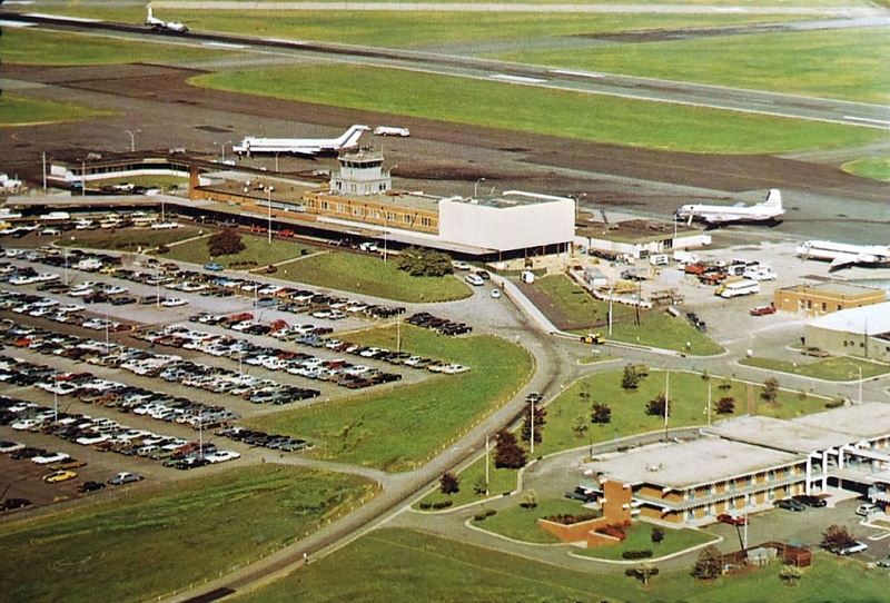
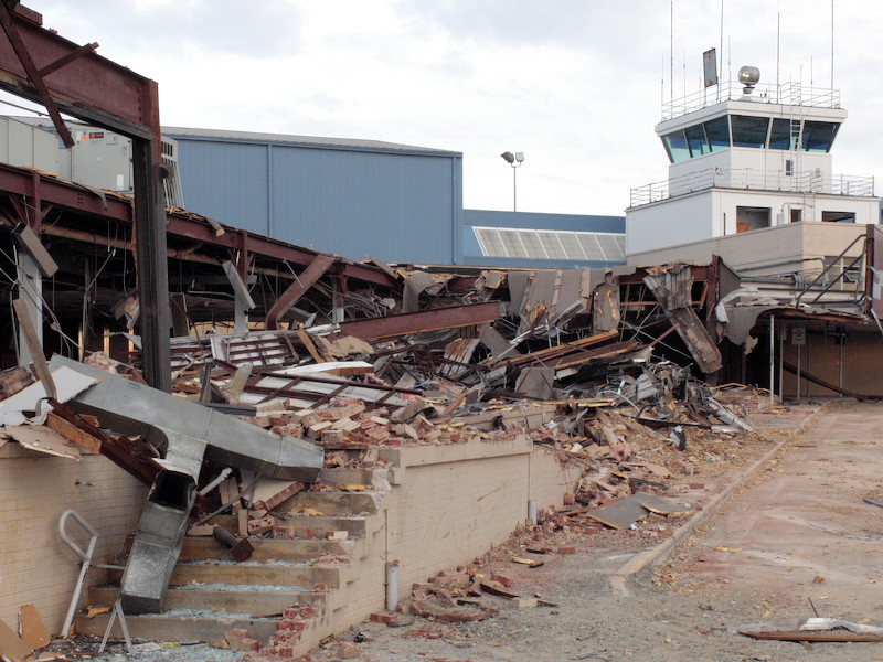
Raleigh-Durham International Airport.
Built in the 1960s, demolished in 2000. The parking garage presently occupies the site.
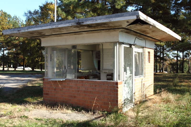
Airport Parking Lot, Abandoned
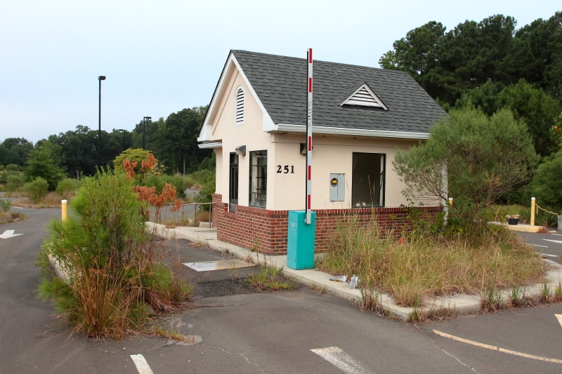
Photographed August 31, 2013
Abandoned airport parking lot on Airgate Drive off Pleasant Grove Church Road in Morrisville.

Photographed August 31, 2013.
Abandoned runway at Raleigh-Durham International Airport, opposite the airport maintenance facility on National Guard Drive.
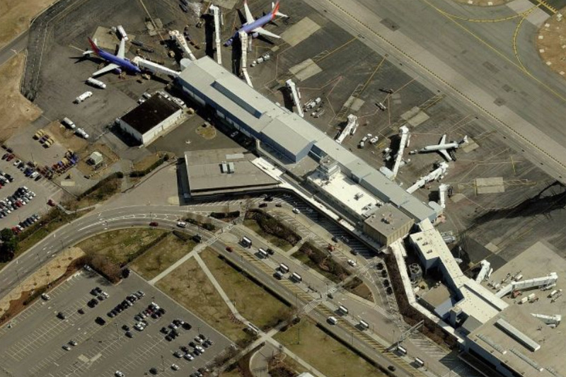
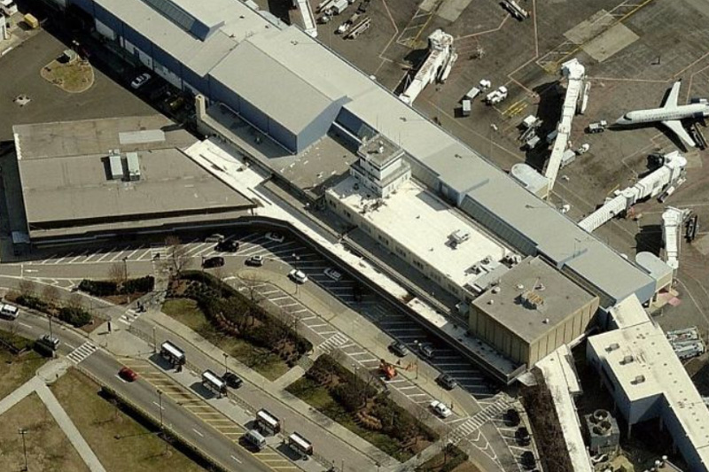
Bing Map aerial photos


Courtesy North Carolina State Archives
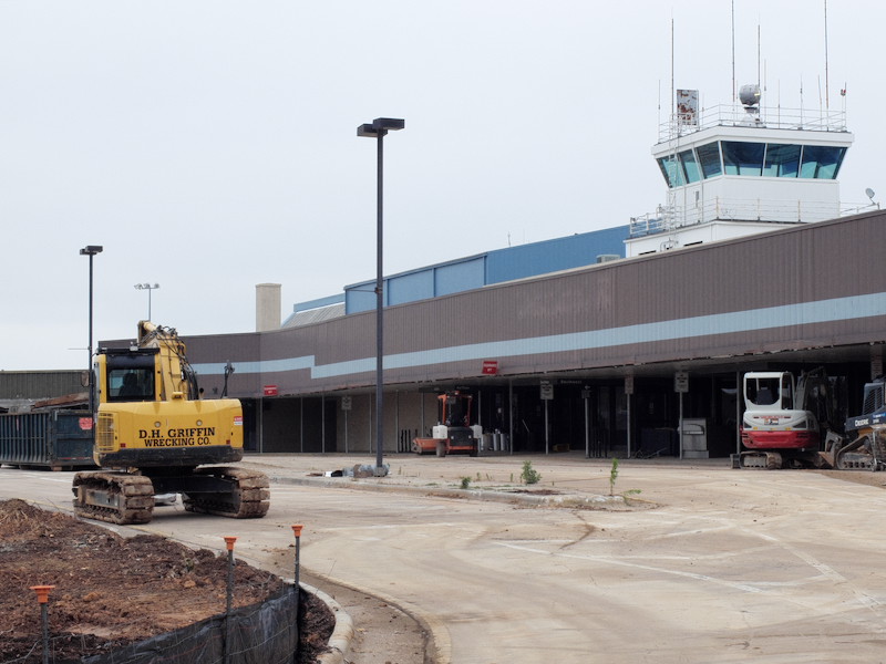
Raleigh-Durham International Airport.
Built in 1955, the brick terminal building replaced a smaller wooden terminal building erected in 1946. The terminal building was expanded over the decades, and both the original terminal building and expansions were demolished in 2016.
![]()
Photographed December 4, 2010
Abandoned recreation area on Beacon Lake Road in east Raleigh.
Photographed November 3, 2013
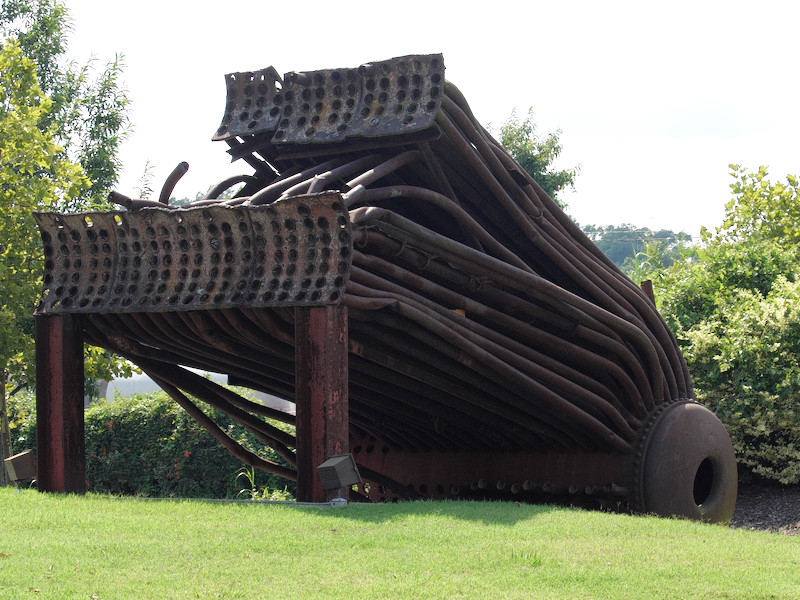
Abandoned industrial facility on Capital Boulevard.

Photographed March 22, 2004
1800 block of Blue Ridge Road
History: Camp Polk originally served
as the only Army tank training base in the United States
during World War I. In 1920, the state obtained the
land for a prison farm and later youth detention
center. In 1963, most of the later buildings were
erected. The prison housed 381 male youths and had 330
employees on 20 acres, 14 of which were fenced. Polk
Youth Center moved to a new facility in Butner in 1998; the
Blue Ridge Road site was abandoned that year and demolished
in 2003.
June 2016 - Site under development as "art park" extension of art museum.
Photographed March 22, 2004
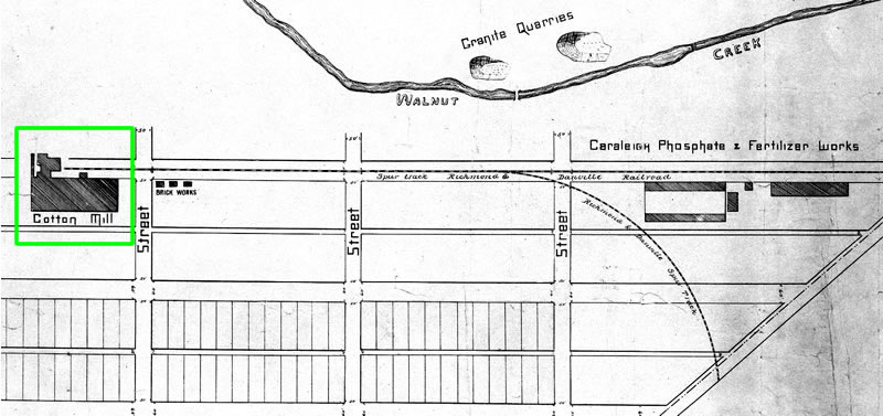
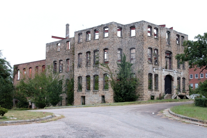
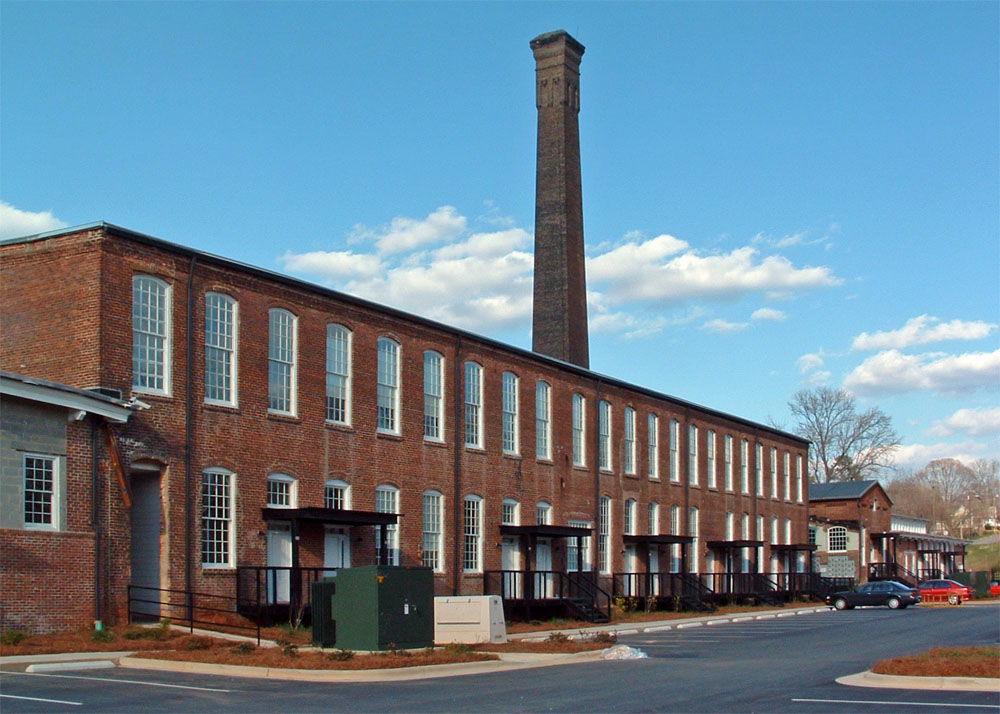
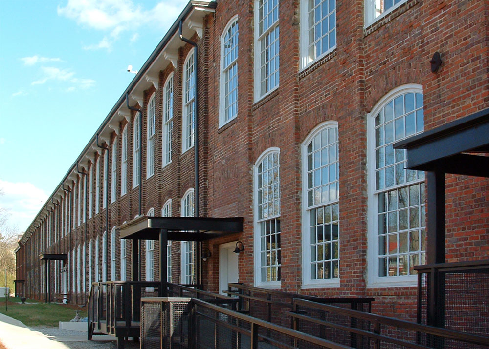
421 Maywood Avenue
History: Built in 1891-92, one of
Raleigh's earliest and largest mill was constructed in south
Raleigh in close proximity to a Norfolk-Southern Railroad
line. In 2001, the mill building was added to the
National Register of Historic Places. In 2003, it
opened for occupancy as condominium space.

Sanborn Map, 1950
Avent Ferry Road
Photographed March 25, 2004

"State Penitentiary, Raleigh, N.C." in Durwood
Barbour Collection of North Carolina Postcards (P077),
North Carolina Collection Photographic Archives, Wilson
Library, UNC-Chapel Hill - Circa 1900-1910
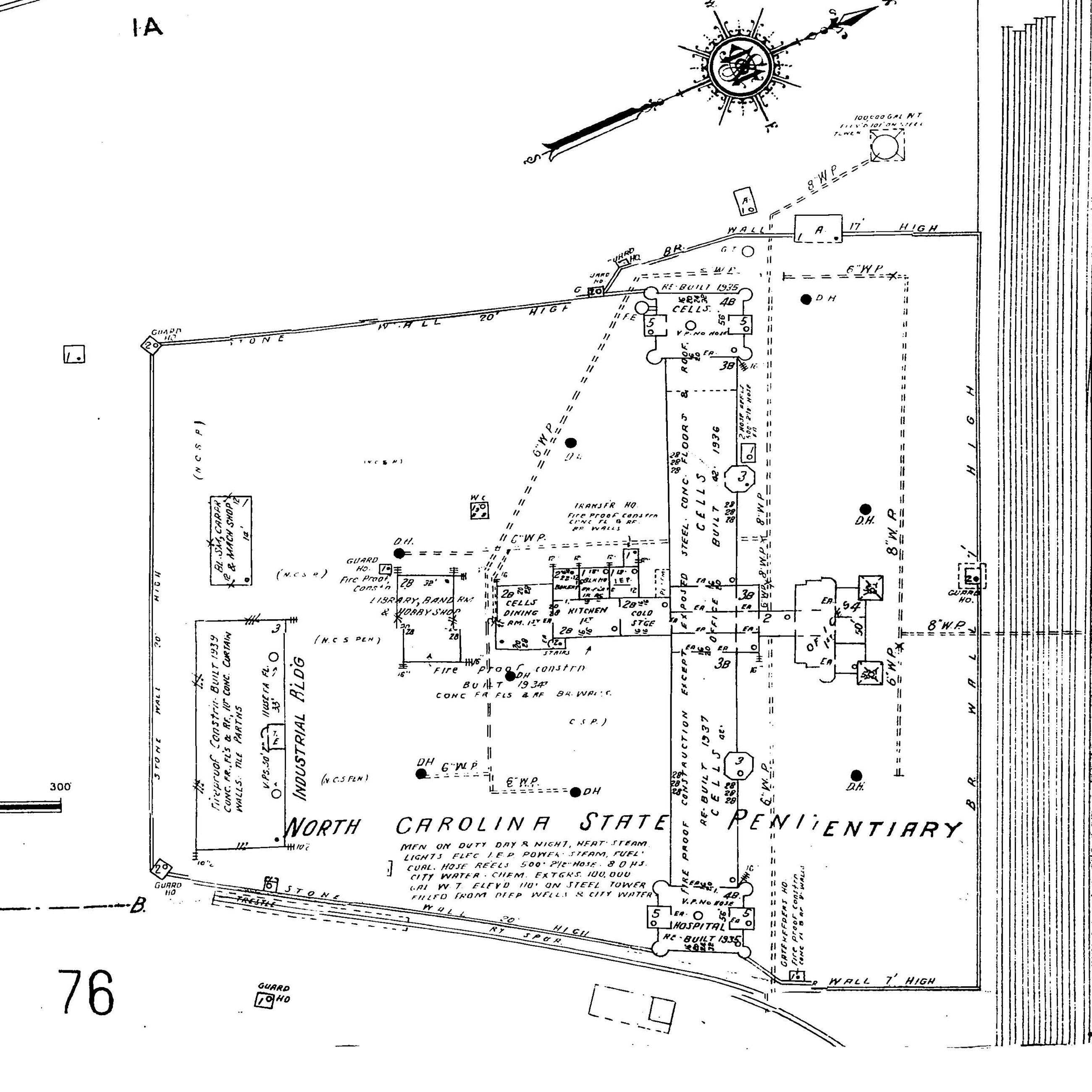
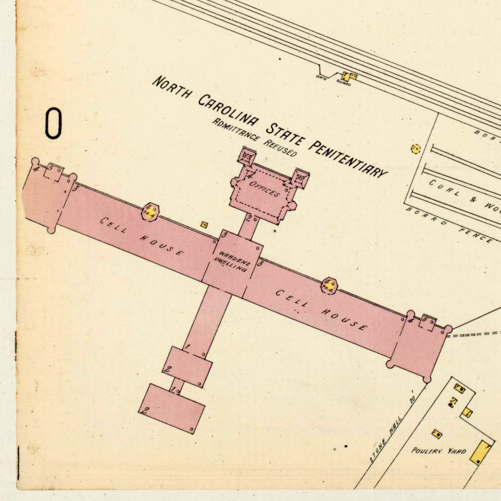
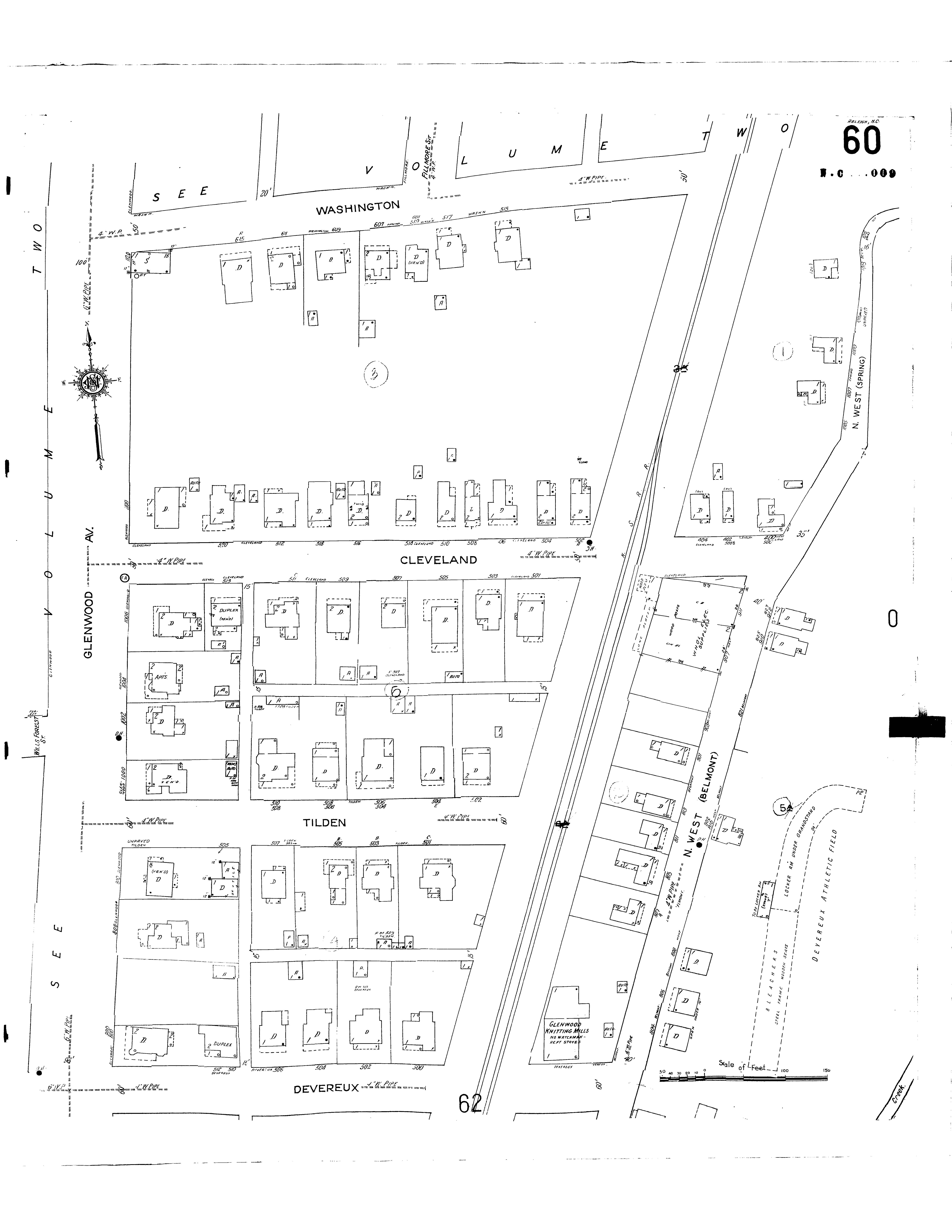
Sanborn Insurance Maps
1300 Western Boulevard
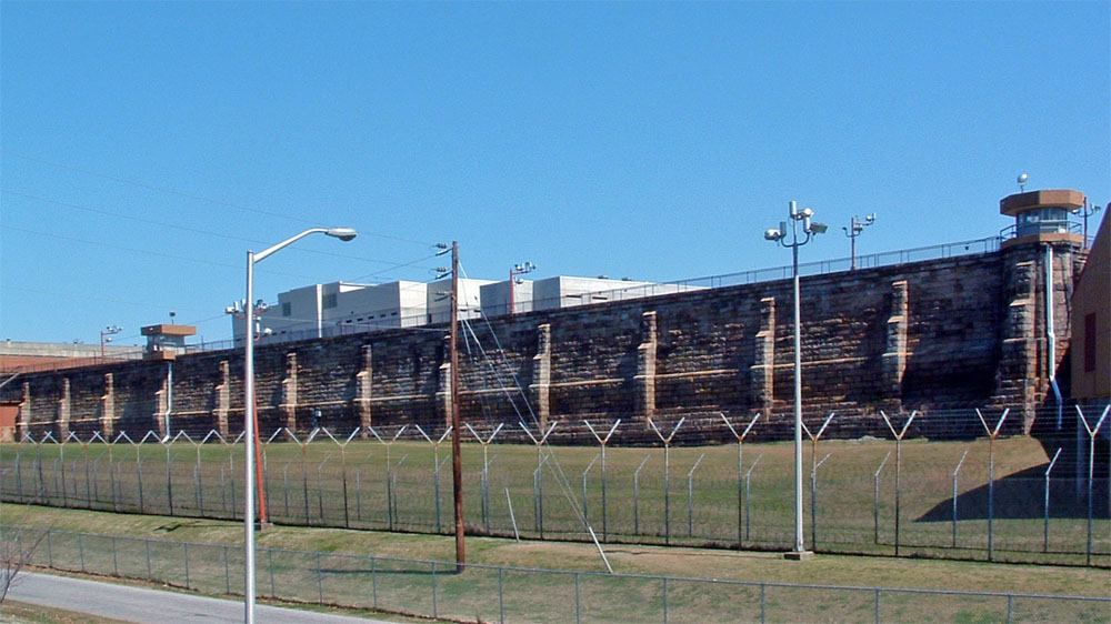
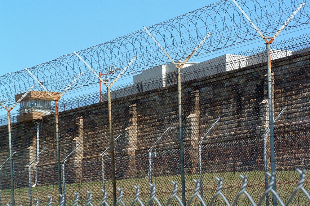
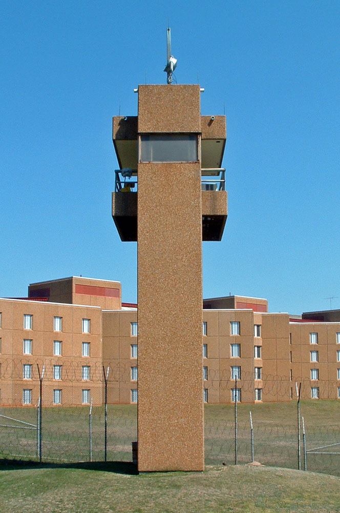
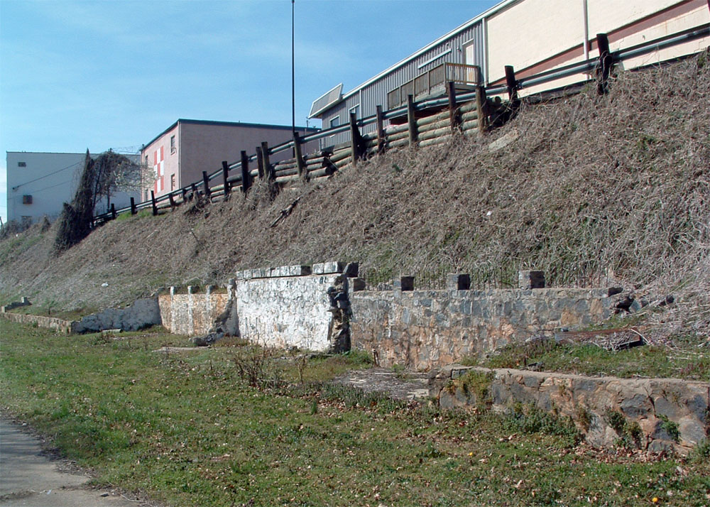
Central Prison (East Side)

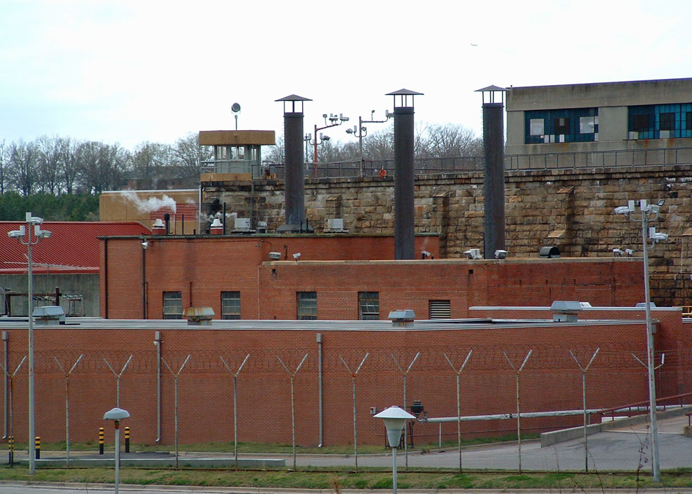
Photographed March 21, 2004
History: Construction was started on the state's first prison in 1870. Built by inmates using granite quarried just outside the prison's east wall, the four-story, Gothic Revival structure was completed in 1884. Before a 1931 renovation, the facility had just one well and spigot for all convict bathing. In 1939-41, an industrial building was added; in 1952-53, a new shop and main building were built; and between 1960-65, hospital and honor grade facilities were constructed. In 1954, all original turrets, battlements, spires, and pointed cupolas were removed after being condemned by the city building inspector. The prison was demolished between 1979 and 1984, replaced by the present facility. Sections of the original 20-foot stone wall are still standing. Sanborn Insurance Maps dated 1914 (left) and 1949 (right) show the original prison building. More information. March 2004.
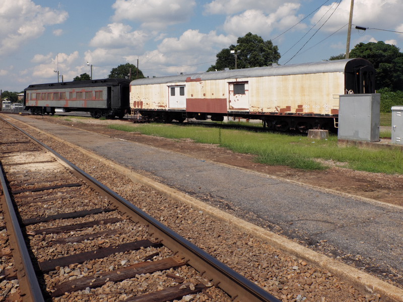
Corrections Facility, Abandoned (demolished)
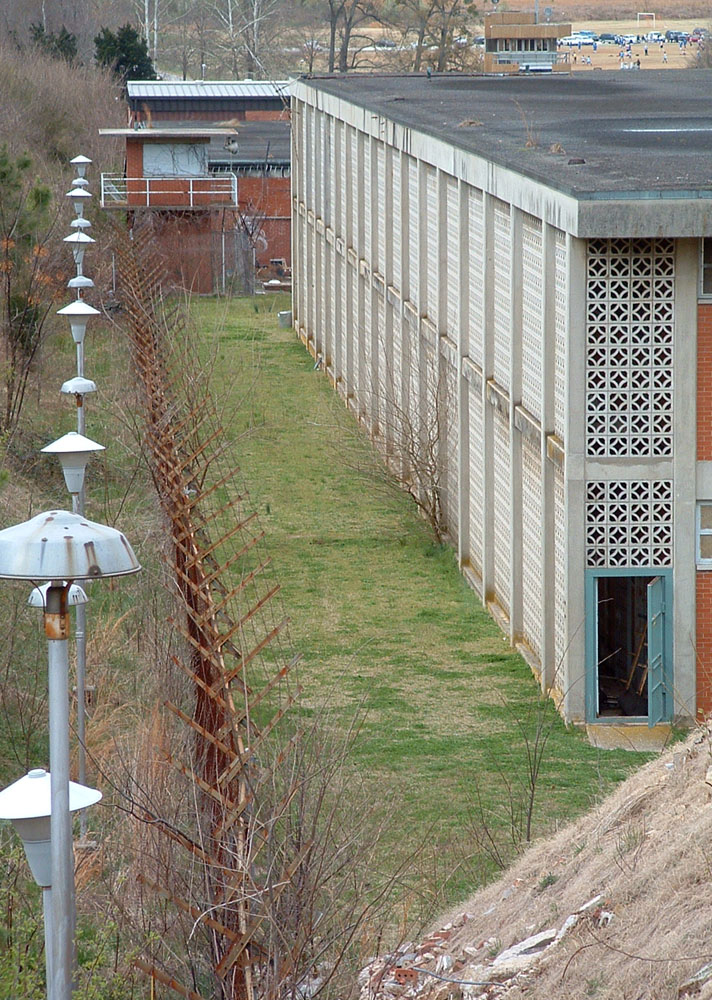
Photographed March 21, 2004
Mountford Avenue beside Central Prison
June 2016 - Building since demolished.

Photographed July 1, 2016
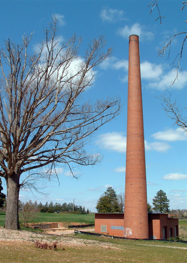
History: This 80,000 square-foot textile mill was constructed in 1890. It was converted to condominium space in 1996. March 2004.
Photographed March 21, 2004
Sanborn Map, 1949
Behind 1014 North West Street
History: The baseball park was completed
in 1939 and demolished in 1979. For decades, the park
was the only full-sized, fully-lit baseball field in
Raleigh. The site presently houses the city's
sanitation department. Trivia: In 1968, the Durham Bulls
merged with Raleigh to form the Raleigh-Durham Mets. The
team played half its games in each of their respective
cities and folded just before the start of the 1972
season. The pictured Sanborn Insurance Map section is
dated 1949. March 2004.
Photographed 2013
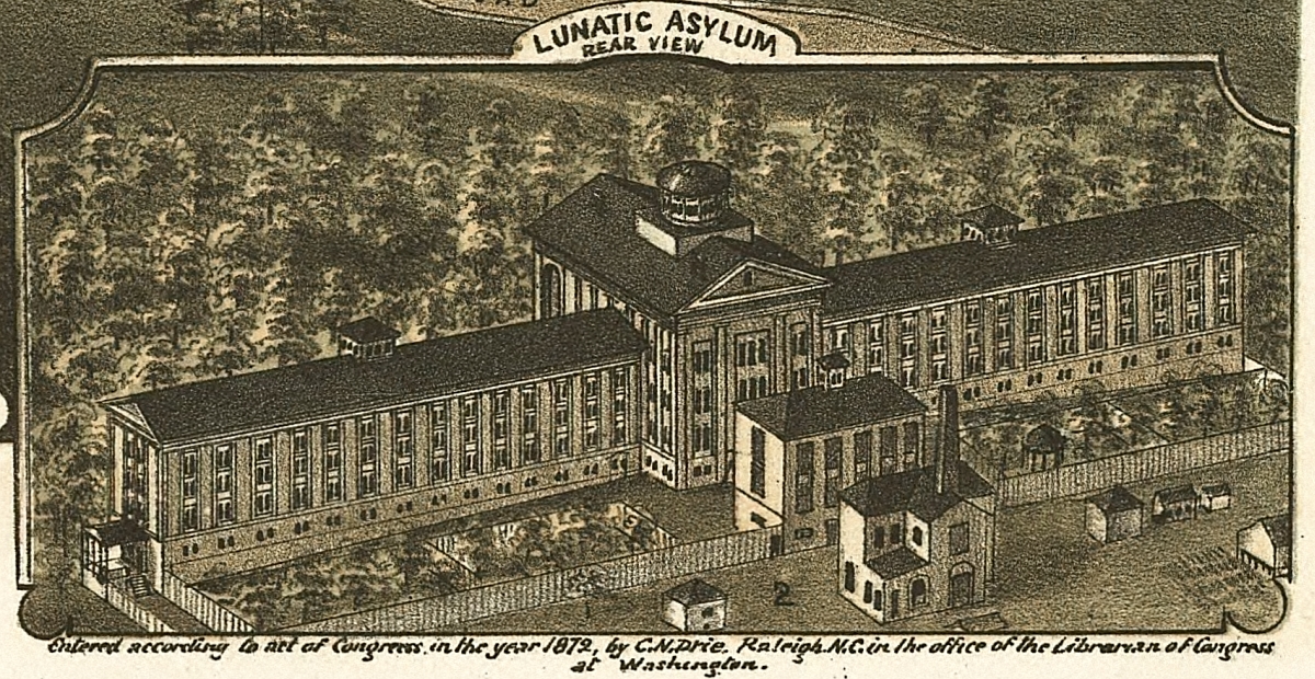
Bird's Eye View of Raleigh, 1872
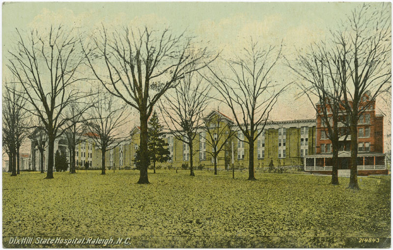
"Dix Hill, State
Hospital, Raleigh, N.C.", in Durwood
Barbour Collection of North Carolina Postcards (P077),
North Carolina Collection Photographic Archives, Wilson
Library, UNC-Chapel Hill

Sanborn Map, 1914
South Boylan Avenue
June 2016 - Ongoing development and demolition of structures on site.
Photographed March 21, 2004

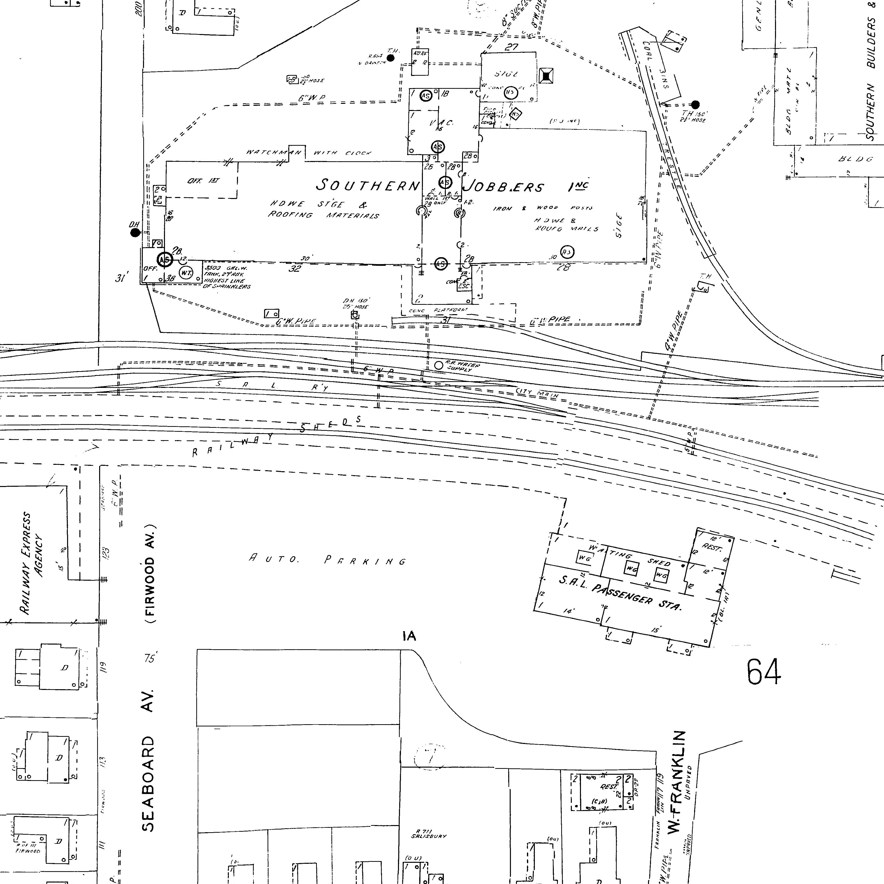
220 Snow Avenue
History: Sanborn Insurance Map dated
1914 (right) shows the building as part of a Southern
Manufacturing Company complex. Located at 220 Snow Avenue,
the 3800 square-foot, three-story building is presently used
as a Wake County homeless service center. March 2004.
Photographed March 22, 2004
1014 Hodges Street
History: The North Carolina State
Farmers Market was relocated in 1991 to a newly constructed
facility on Agricultural Street off Lake Wheeler Road. March
2004.
Photographed March 21, 2004
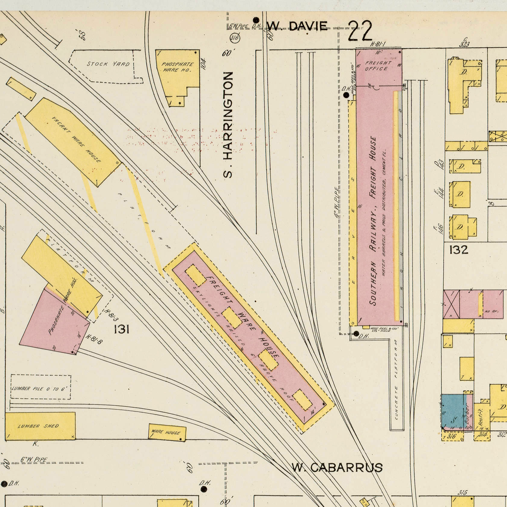
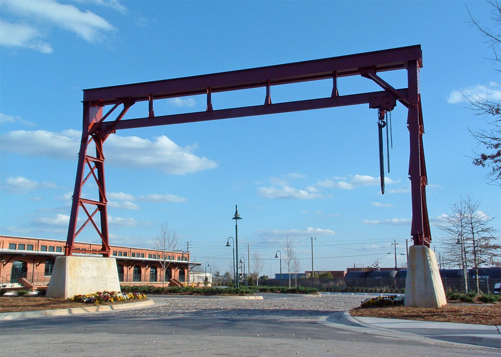
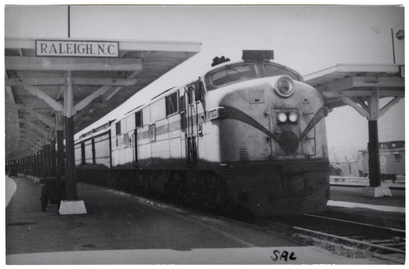
West Davie Street
History: This freight crane was
refurbished and relocated to the main entrance drive of the
renovated Southern Railway freight depot. The downtown
building at 327 West Davie Street was built in 1912 and is
shown right in a Sanborn Insurance Map from 1914. March
2004.
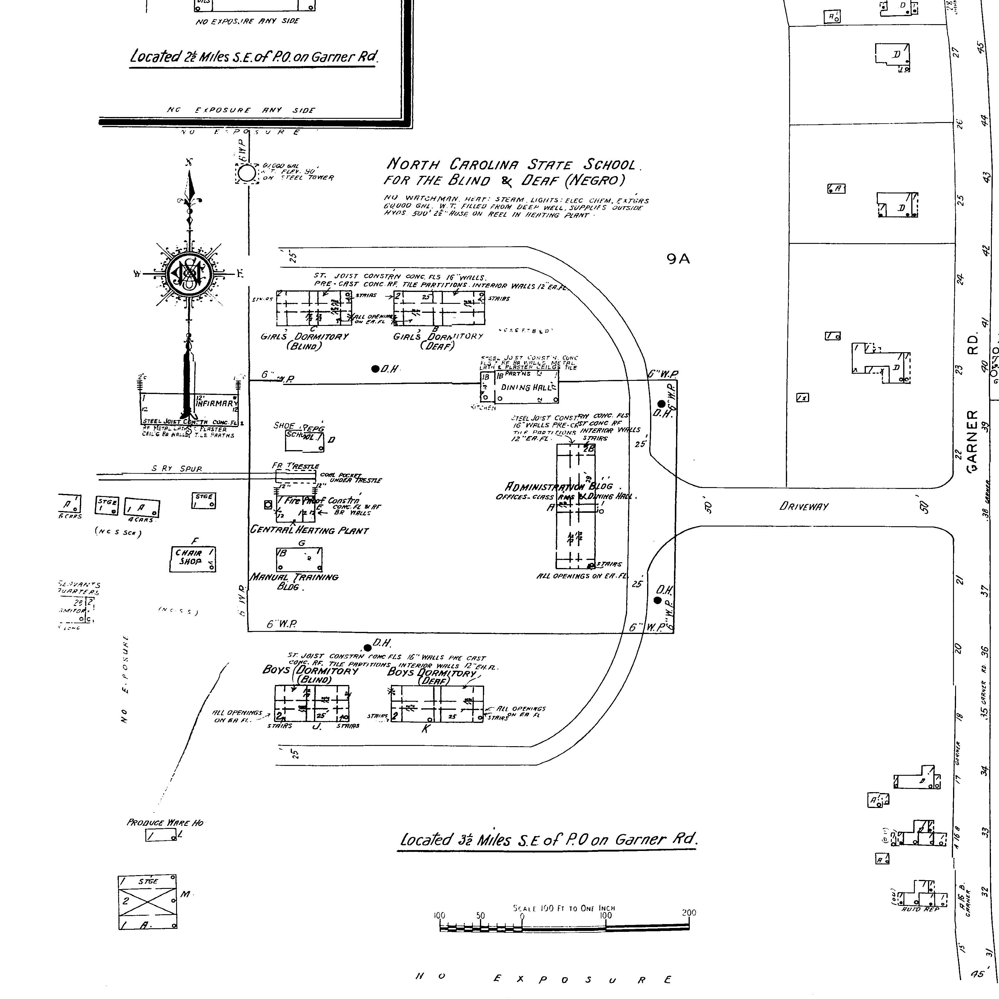
Governor Morehead
School, Garner Road
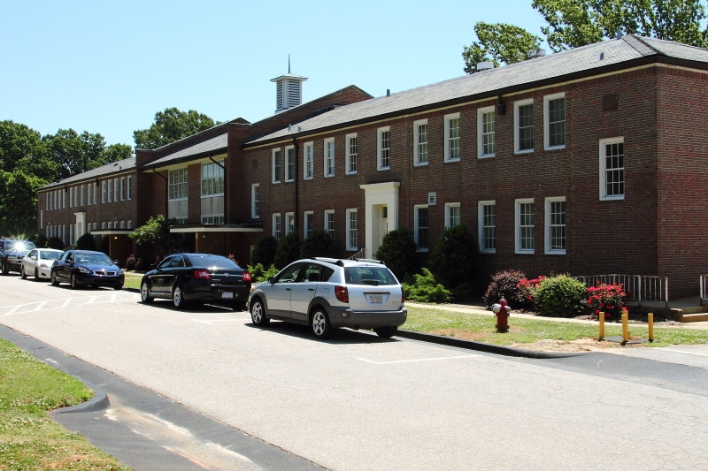
Photographed 2015
Sanborn Map, 1950
Photographed March 28, 2004
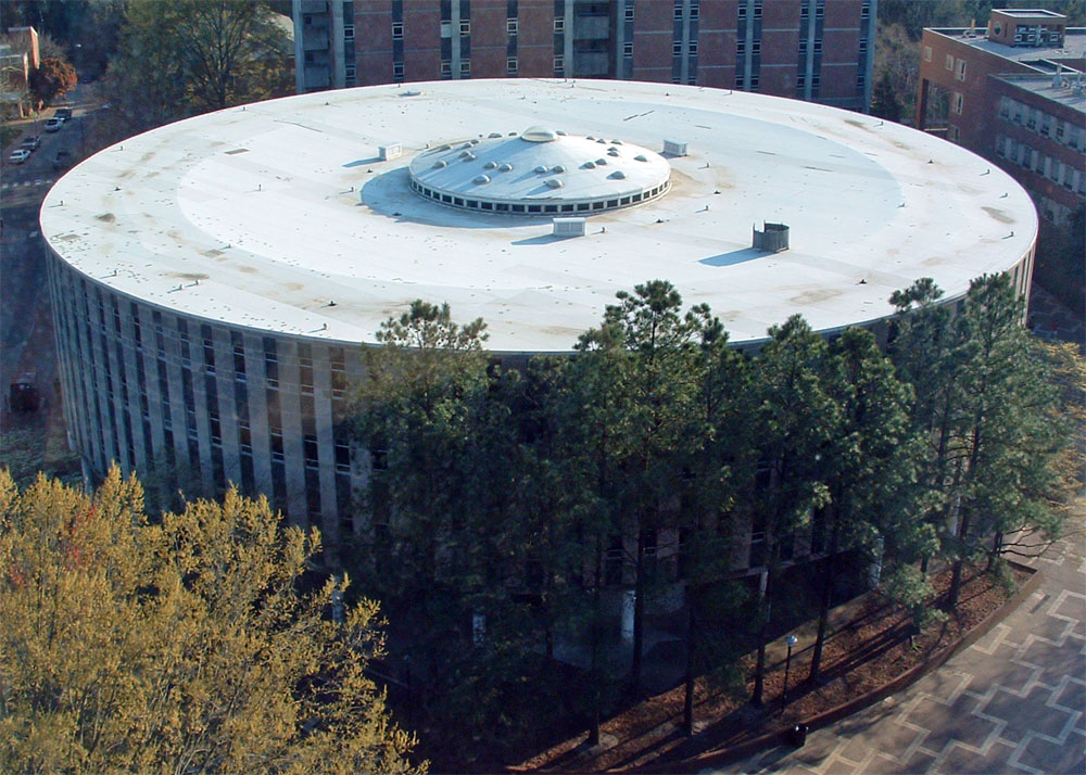
North Carolina State University
History: The first cylindrical
classroom structure ever built on a university campus has a
206 foot diameter, was built in 1962, and is named for John
William Harrelson (1885-1955), the first alumnus to serve as
chief administrator of the college. The building has
housed the Mathematics department since its construction.
March 2004.
June 2016 - Since demolished.
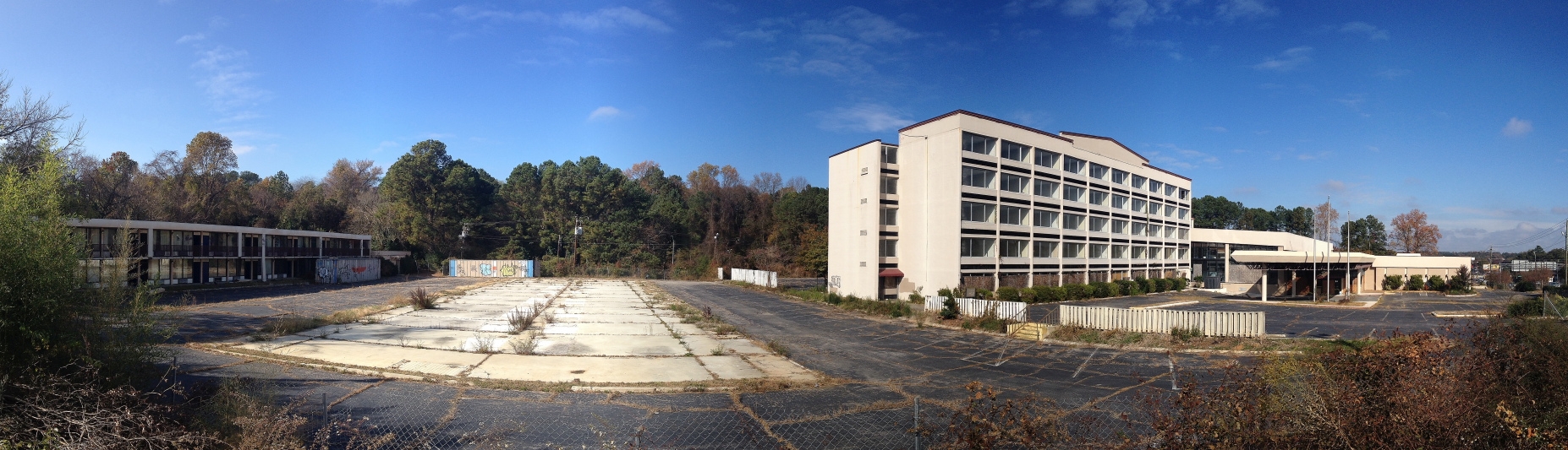
Photographed November 17, 2013.
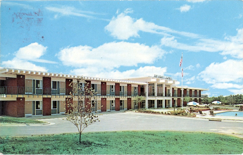
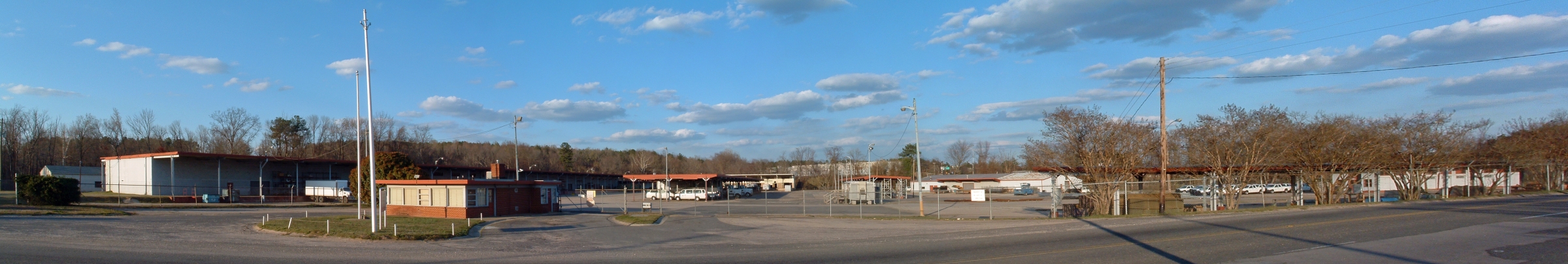
Old Holiday Inn North on Capital Boulevard. Built 1981.
Photographed March 21, 2004

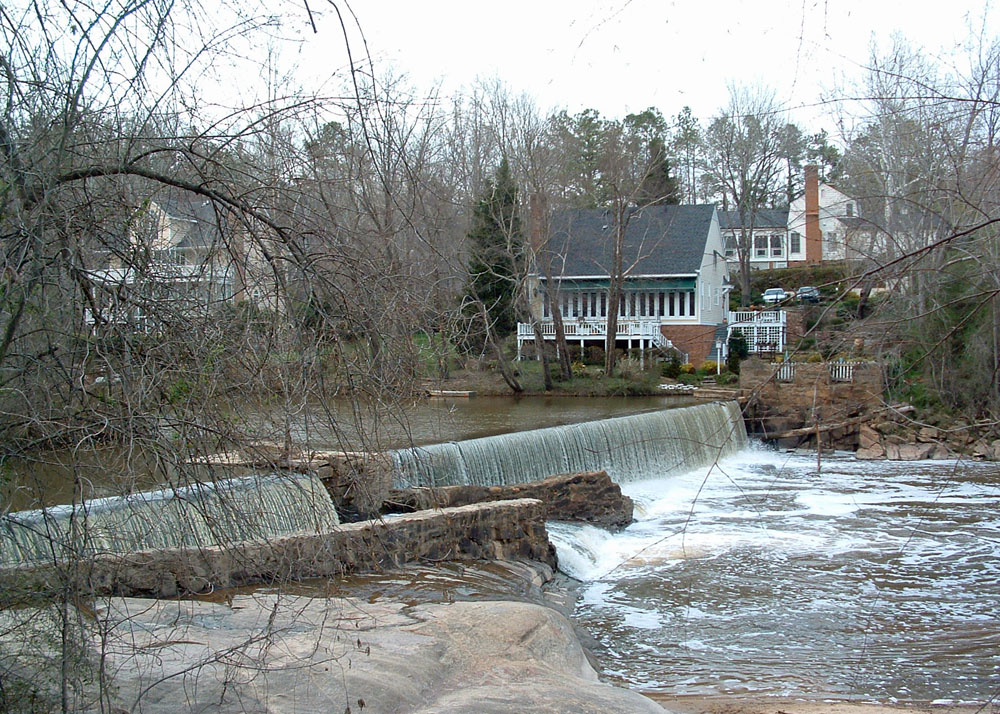
"Lassiters Mill. Flour, Meal and Feed, Raleigh, N.C.", Durwood
Barbour Collection of North Carolina Postcards (P077), North
Carolina Collection Photographic Archives, Wilson Library,
UNC-Chapel Hill
History: Originally known as the "Great Falls of Crabtree," this site is one of the oldest mill sites in Wake County. Cornelius J. Lassiter purchased the land in 1908 and constructed a grist mill that operated for fifty years until burning in 1958. The site was also a popular picnic and swimming area for Raleigh residents. March 2004.
Photographed March 28, 2004
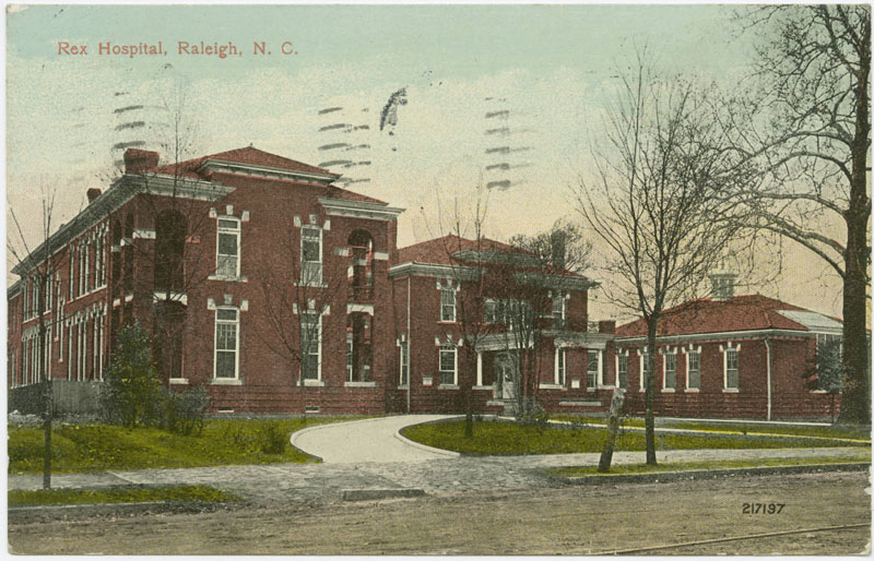
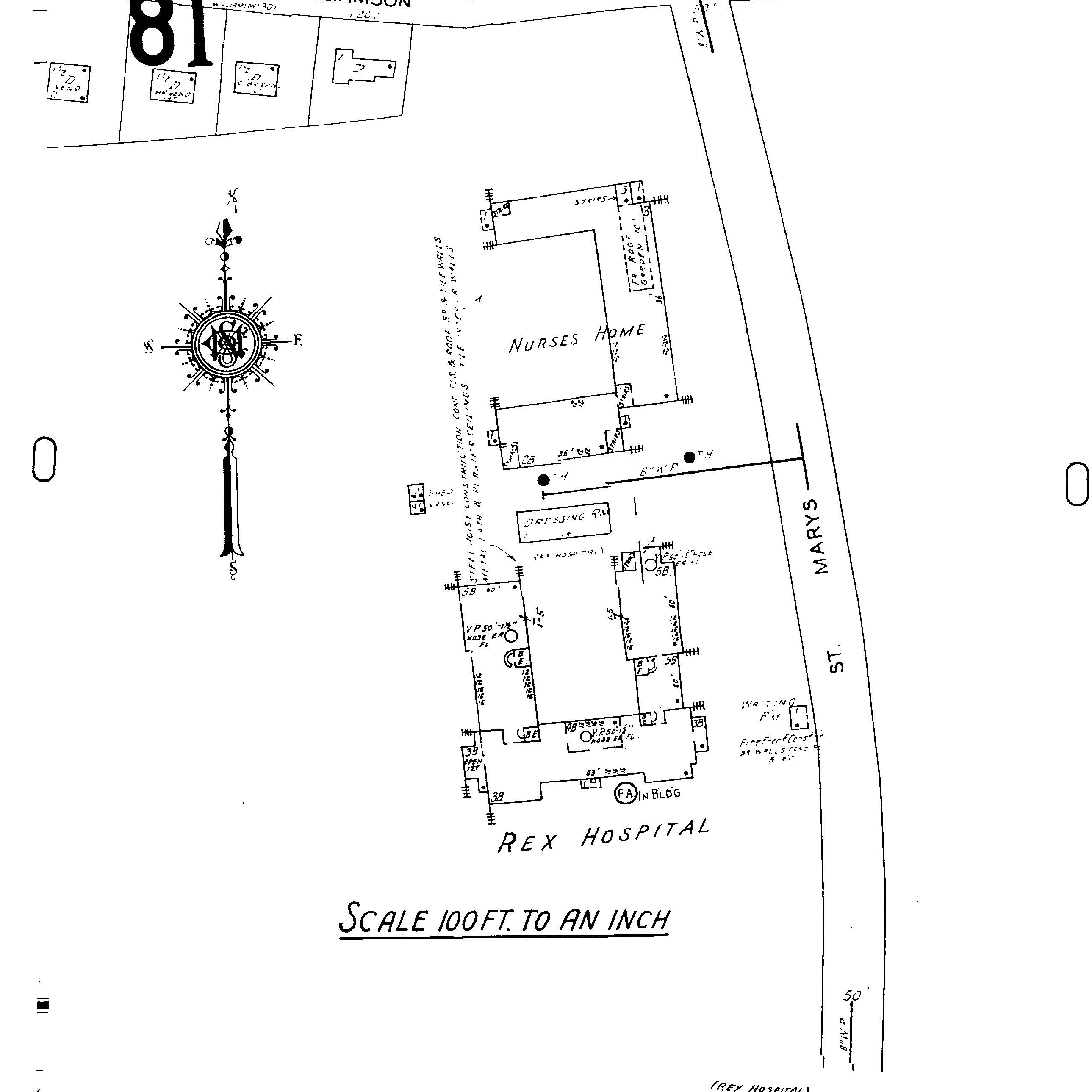
"Rex Hospital, Raleigh, N.C." postcards in Durwood
Barbour Collection of North Carolina Postcards
(P077), North Carolina Collection Photographic
Archives, Wilson Library, UNC-Chapel Hill
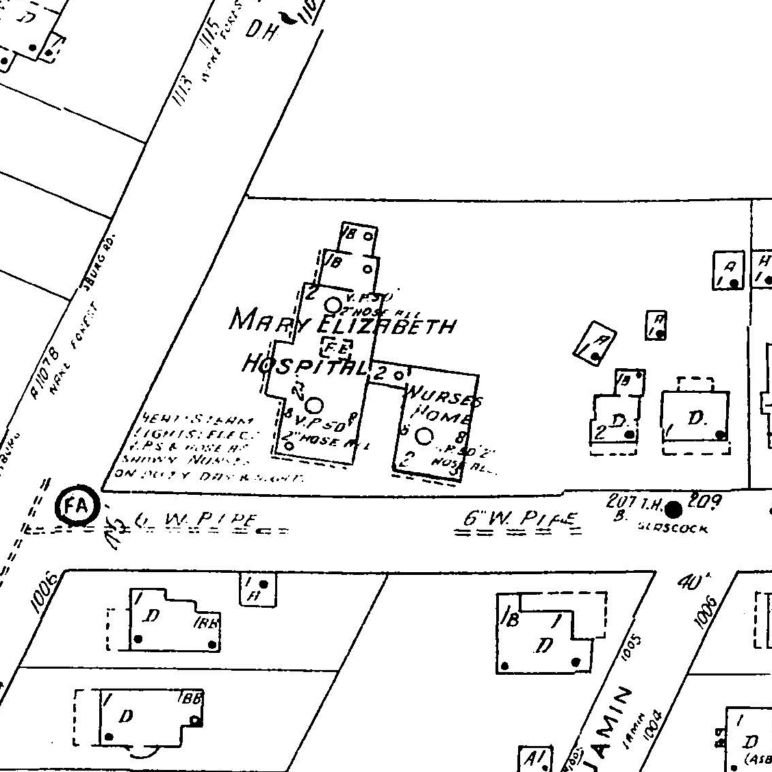
Sanborn Map, 1949
1100 Wake Forest Road
Photographed March 28, 2004
History: Located at the corner of
Glascock Street and Wake Forest Road, the hospital opened
its doors in 1914. Later renamed Raleigh
Community Hospital, the facility moved to its present
location at 3400 Wake Forest Road in 1978. March 2004.
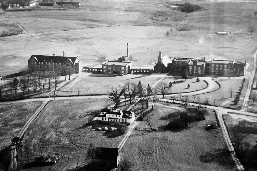
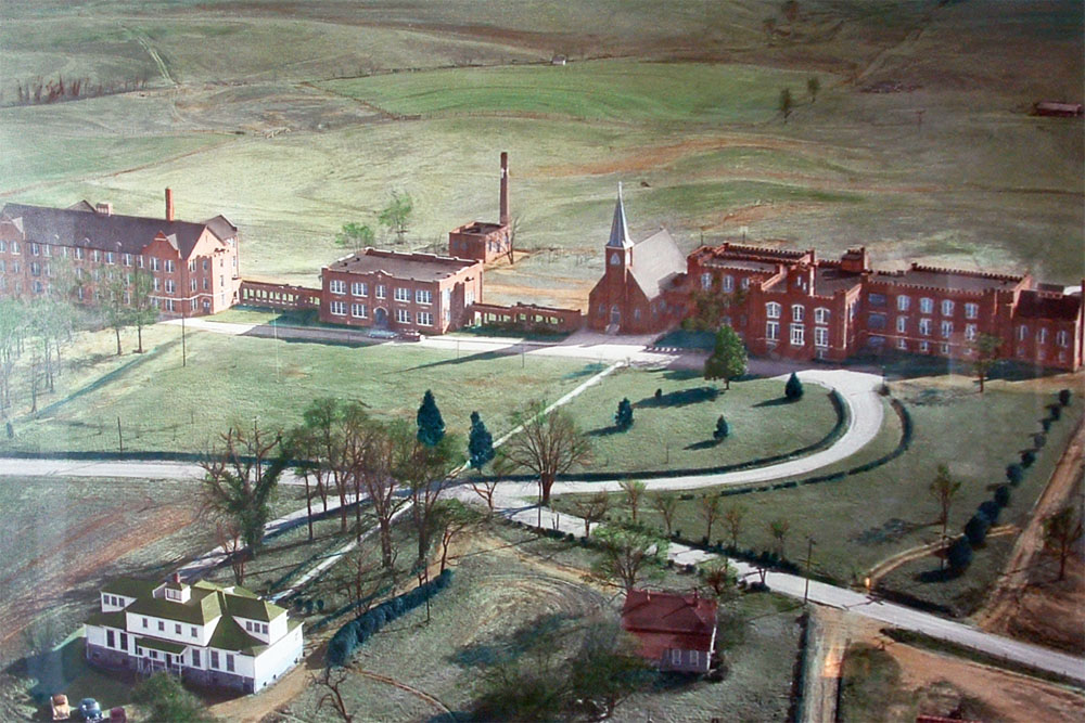
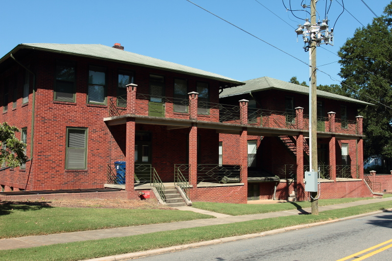
Methodist Orphanage, Old
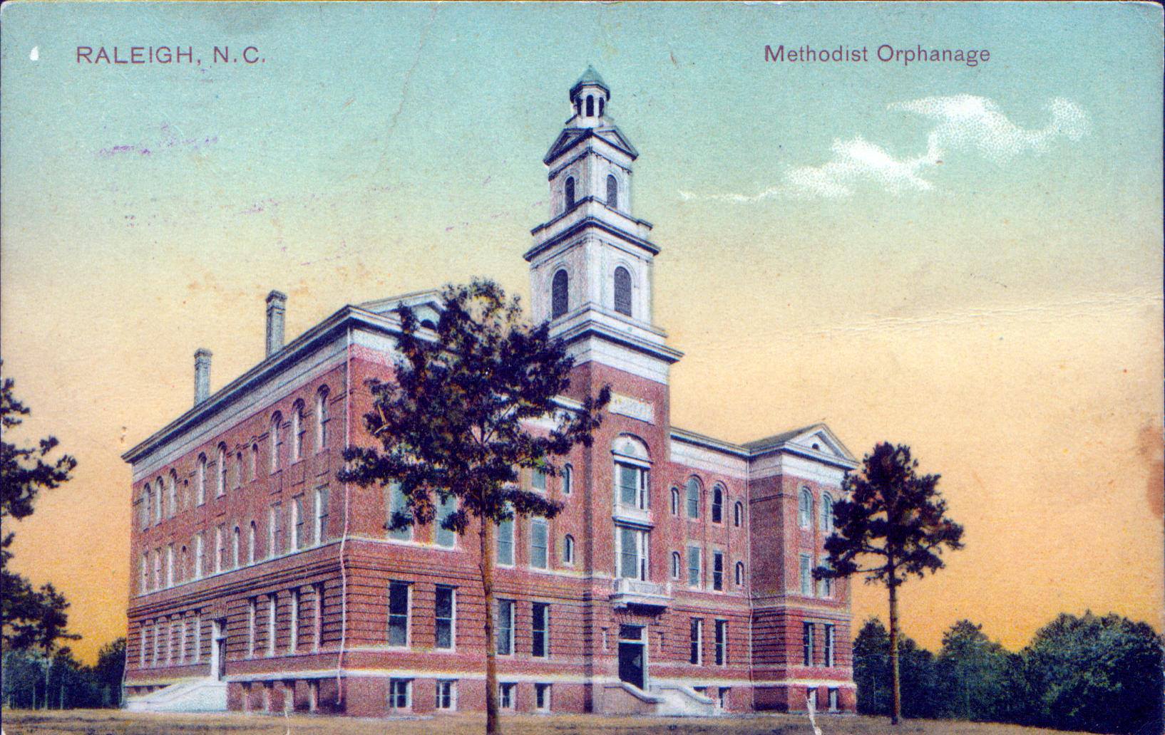
"Raleigh, N.C. Methodist Orphanage," Durwood Barbour
Collection of North Carolina Postcards (P077), North
Carolina Collection Photographic Archives, Wilson Library,
UNC-Chapel Hill
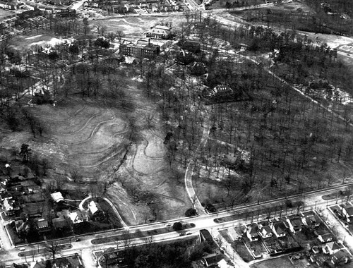

Aerial photograph dated
March 28, 2002
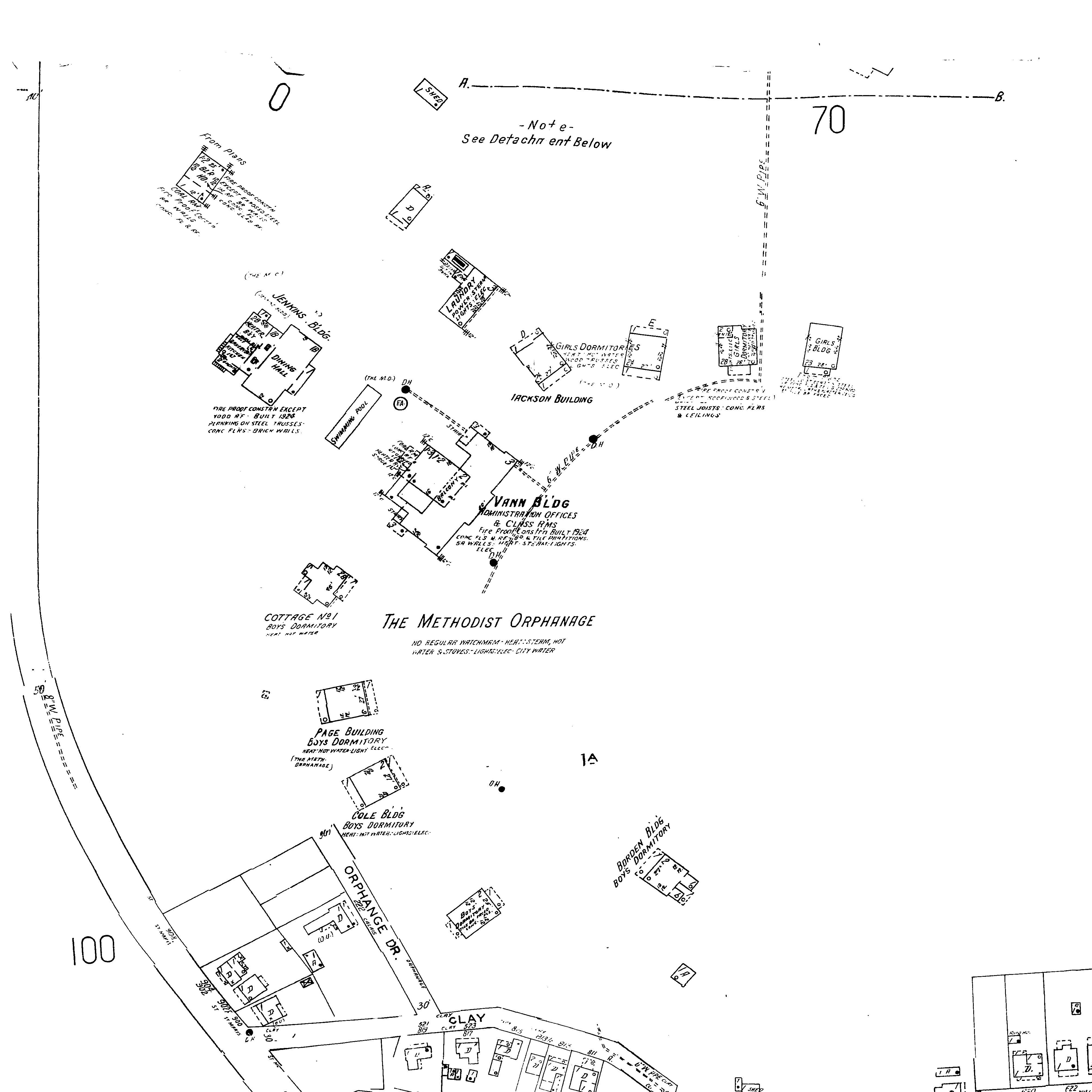
Sanborn Maps, 1950
Orphanage Drive, off Clay Street, off Saint Mary's Street


Photographed July 1, 2016

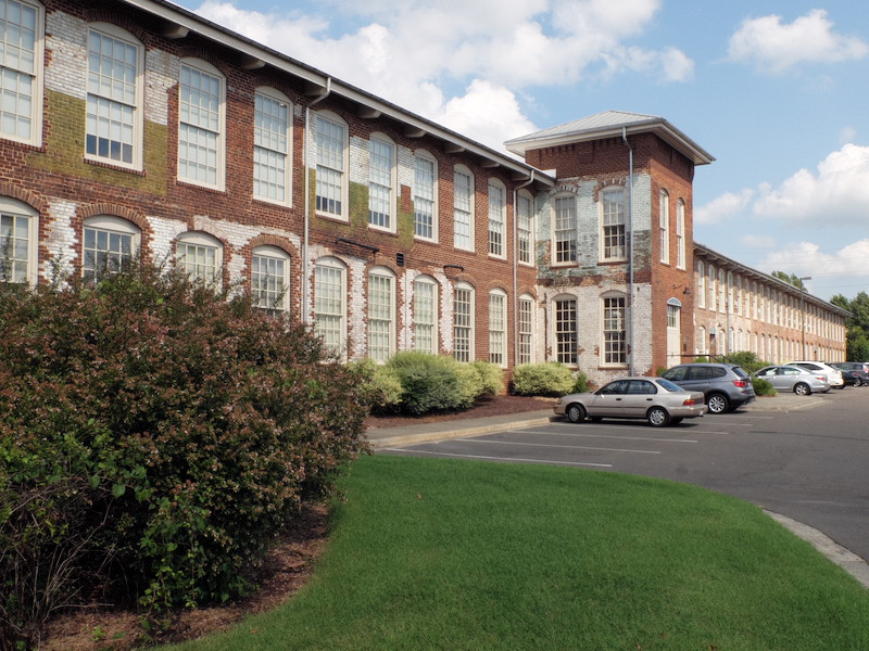
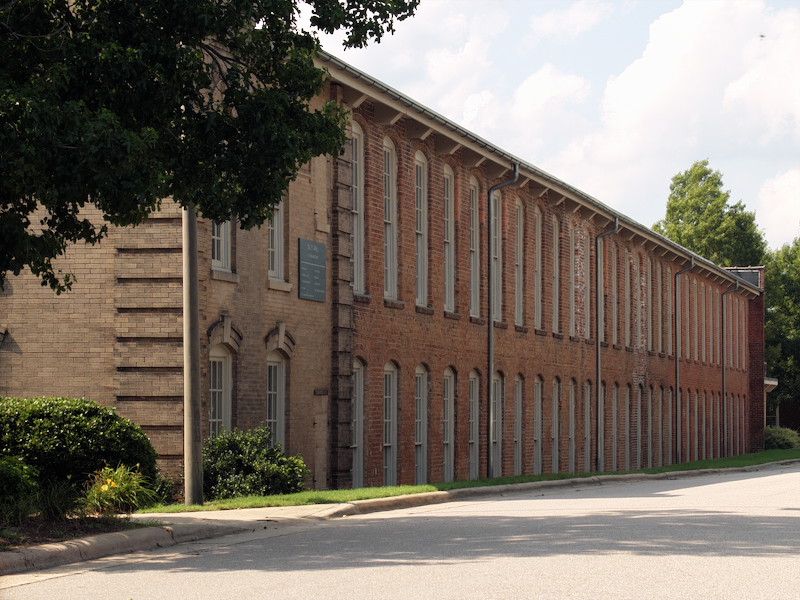
Sanborn Insurance Map
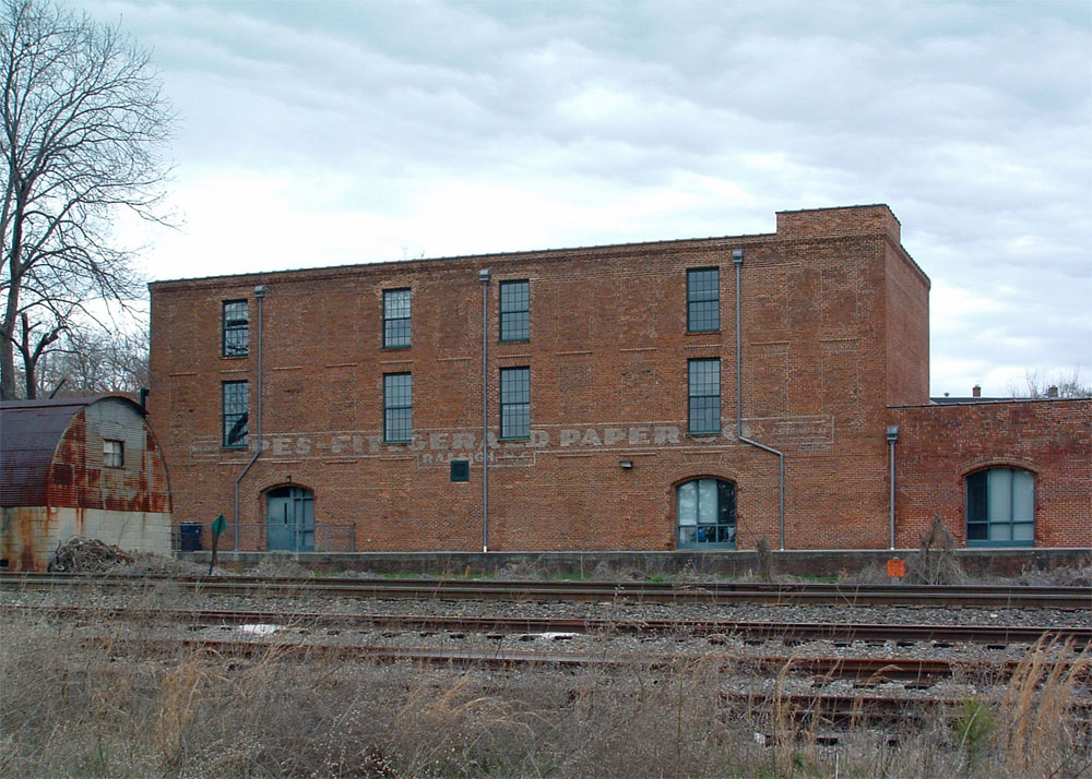
1100 block of Hayne Street
History: Pilot Mills was established
in 1892. The cotton mill closed in 1982. The
1903 building presently houses condominiums and the 1910
building presently houses a charter high school. March 2004.
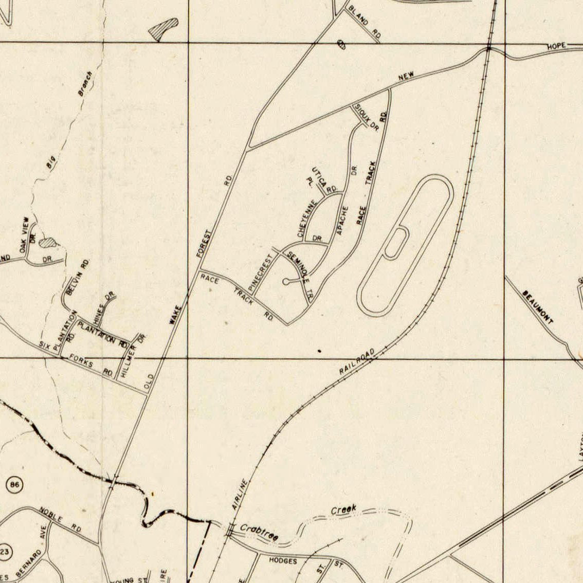
Street Map, 1959
Southwest of present intersection of Atlantic Avenue and New
Hope Church Road
History: The approximately mile-long track
was built in the mid 1950s and demolished by the late 1960s.
Raleigh Municipal Airport, Old
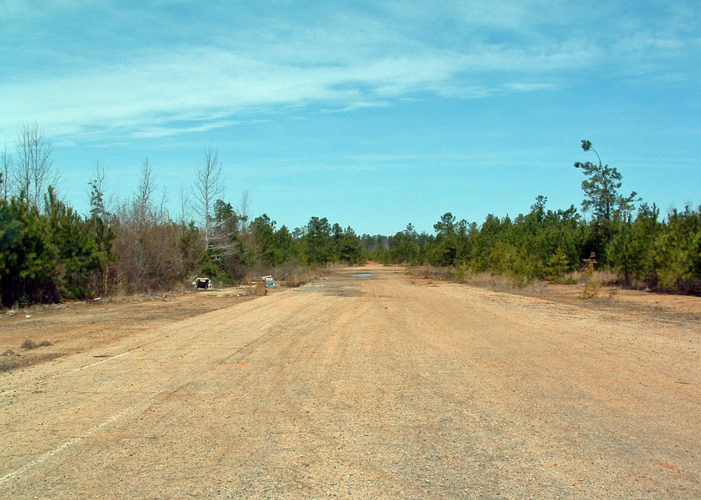
Photographed March 21, 2004
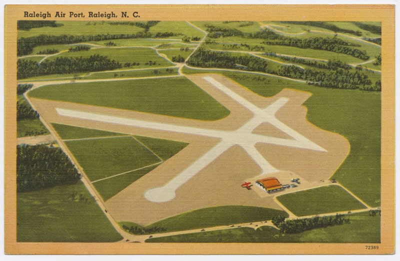
"Raleigh Air Port," Durwood
Barbour Collection of North Carolina Postcards (P077), North
Carolina Collection Photographic Archives, Wilson Library,
UNC-Chapel Hill

Champion Map, c.1960
History: Opened in 1929, Raleigh's first air transportation hub was constructed with three runways and a hanger at the present-day intersection of Tryon Road and Highway 70. Though all commercial traffic moved to the new Raleigh-Durham Airport in the early 1940s, the south Raleigh airport remained in operation until 1972. The hangar and airport administration building were demolished in 1974. More information. March 2004.
June 2016 - Most of original airport site has been redeveloped as housing.
Recommended Links:
Abandoned & Little-Known Airfields - Raleigh Municipal Airport, Raleigh, NC

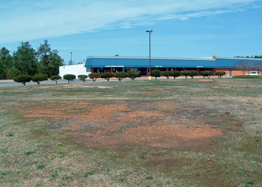
Photographed March 25, 2004
1800 block of Fayetteville Street

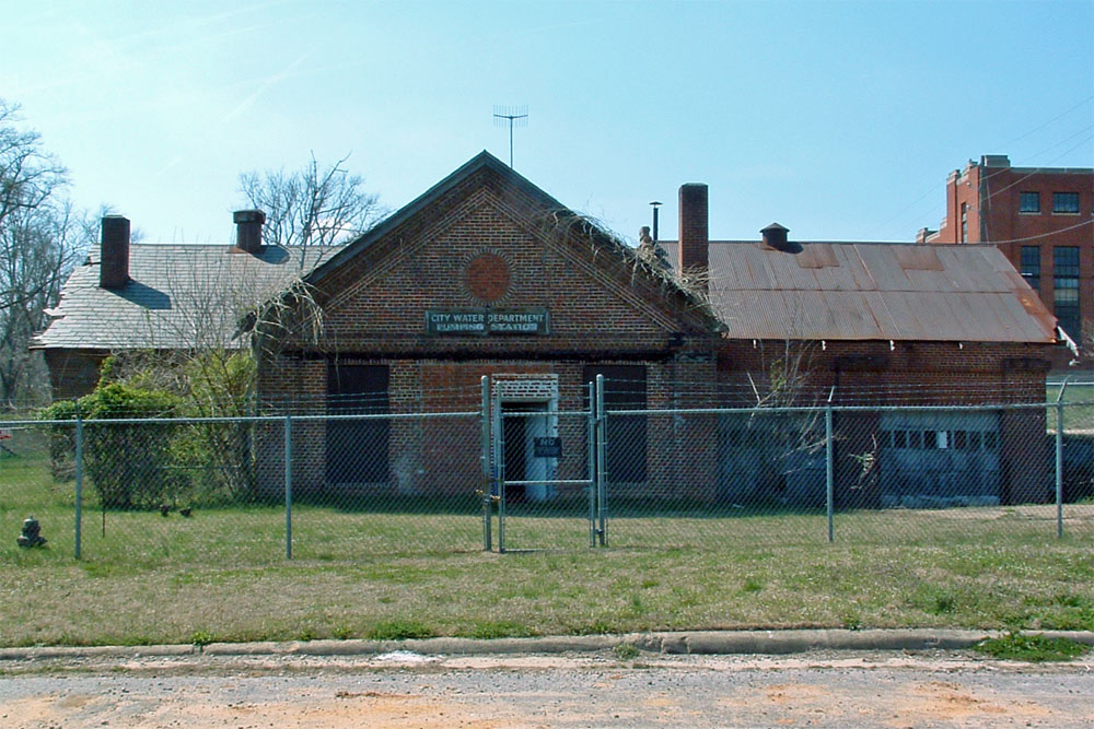
Photographed March 22, 2004
1810 Fayetteville Street
History: The pumping station at was
built in 1939. March 2004.

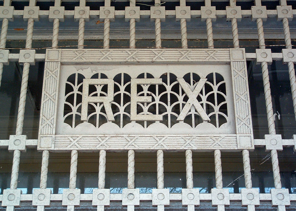
Photographed March 28, 2004

"Rex Hospital, Raleigh, N.C." postcards in
Durwood Barbour Collection of North Carolina
Postcards (P077), North Carolina Collection
Photographic Archives, Wilson Library, UNC-Chapel
Hill
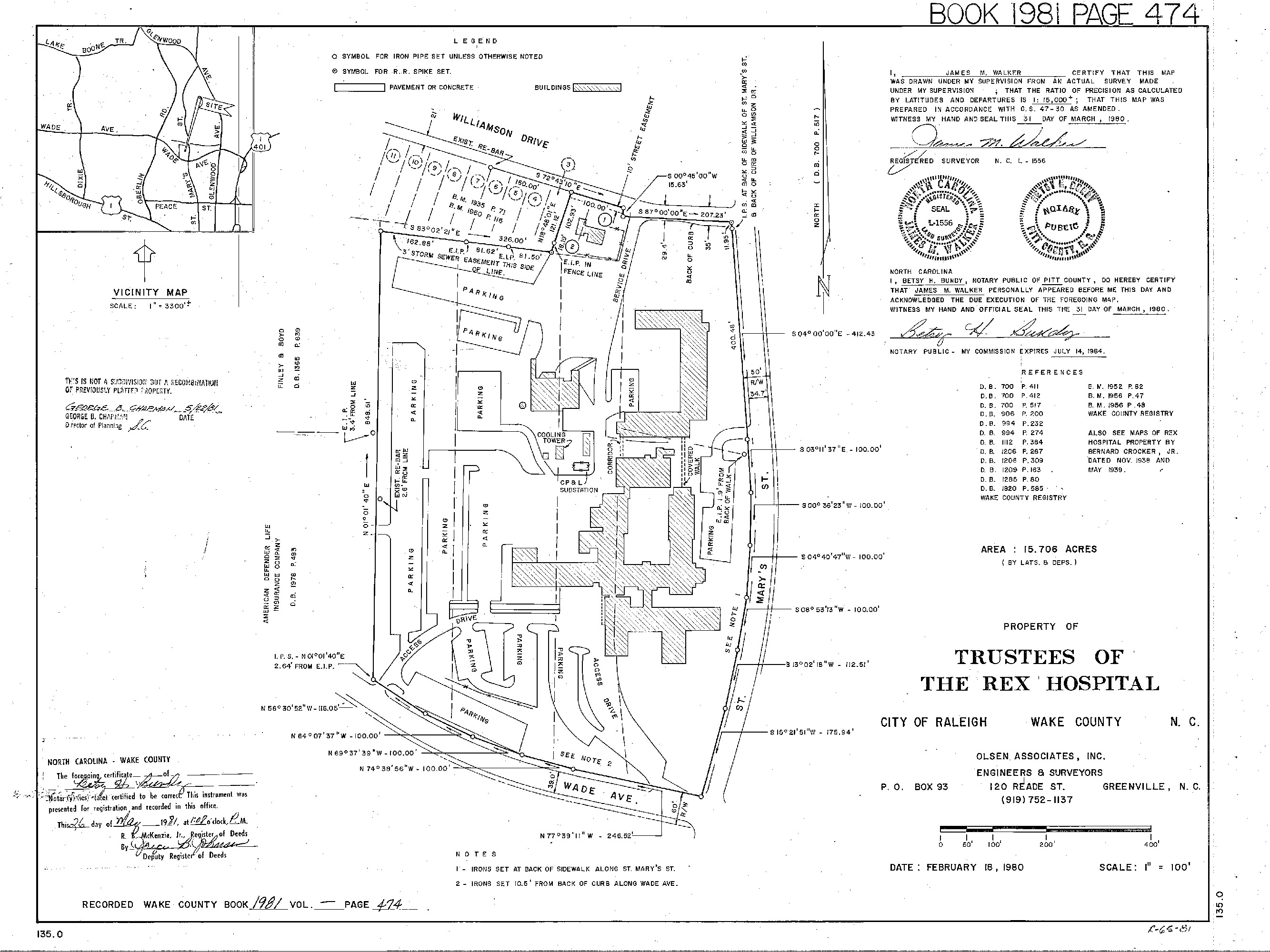
Land survey 1980
Sanborn Insurance Maps
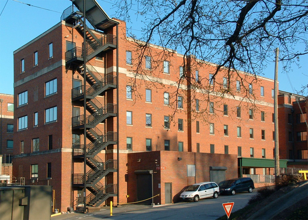
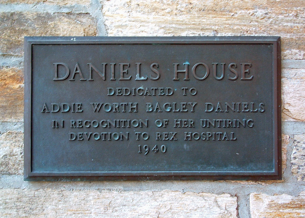
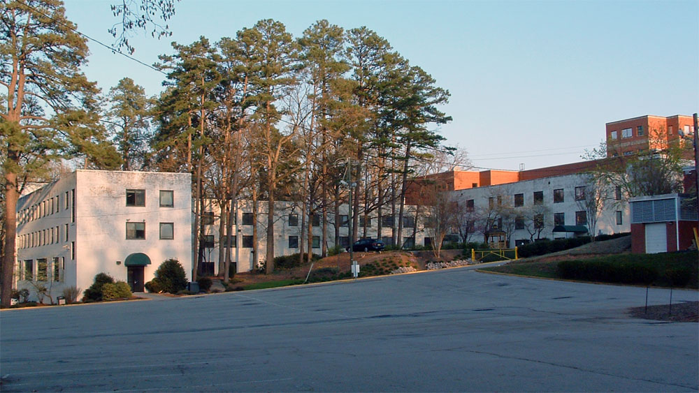
Corner of Wade Avenue and Saint Mary's
Street
History: Opened in 1937, the hospital moved to its present
location at 4420 Lake Boone Trail in
1980. March 2004.
Photographed 2004

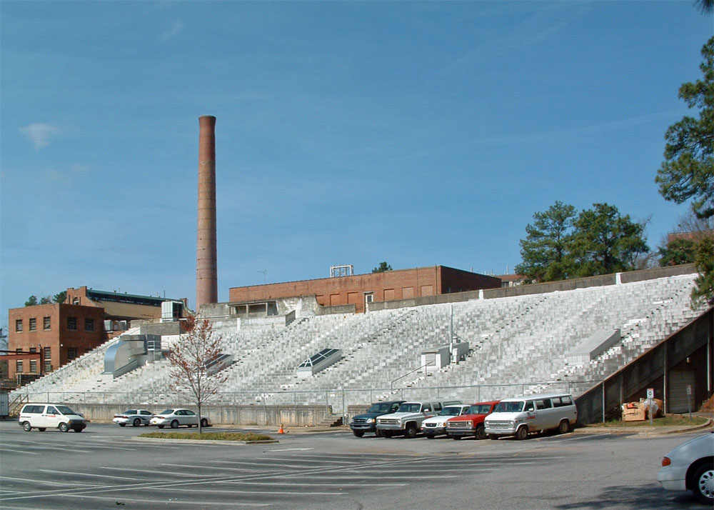
"Riddick Stadium," postcard in Durwood Barbour Collection of North Carolina
Postcards (P077), North Carolina Collection
Photographic Archives, Wilson Library, UNC-Chapel
Hill
Sanborn Insurance Map
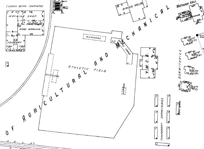
North Carolina State University
History: Riddick Stadium was
completed in 1907. The pictured concrete bleachers were
constructed after the Depression, followed by the West
Stands, East Stands, and Field House. The latter is
still standing, occupied by the campus Public Safety
department. In 1968, football and baseball games were
moved to Carter-Finley Stadium. The stands were
demolished and a parking lot was paved. More
information. March 2004.
June 2016 - Site since demolished.
Photographed 2013

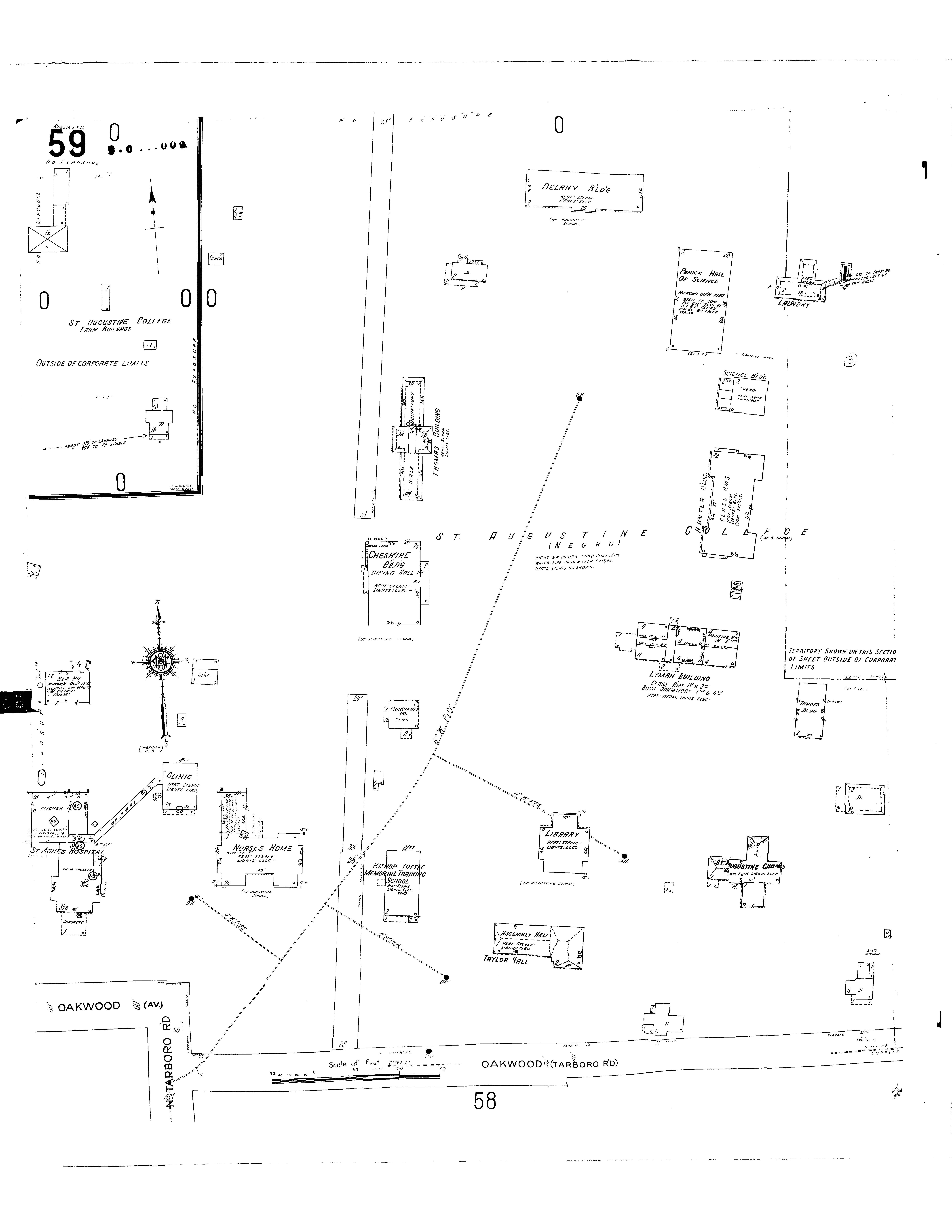
Sanborn Maps, 1909, 1949
Corner of Oakwood and Tarboro roads, on the Saint Augustine College campus.

Photographed July 1, 2016
Durwood Barbour
Collection of North Carolina Postcards (P077), North
Carolina Collection Photographic Archives, Wilson Library,
UNC-Chapel Hill
Sanborn Maps, 1950
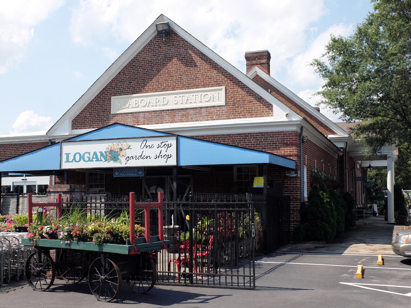
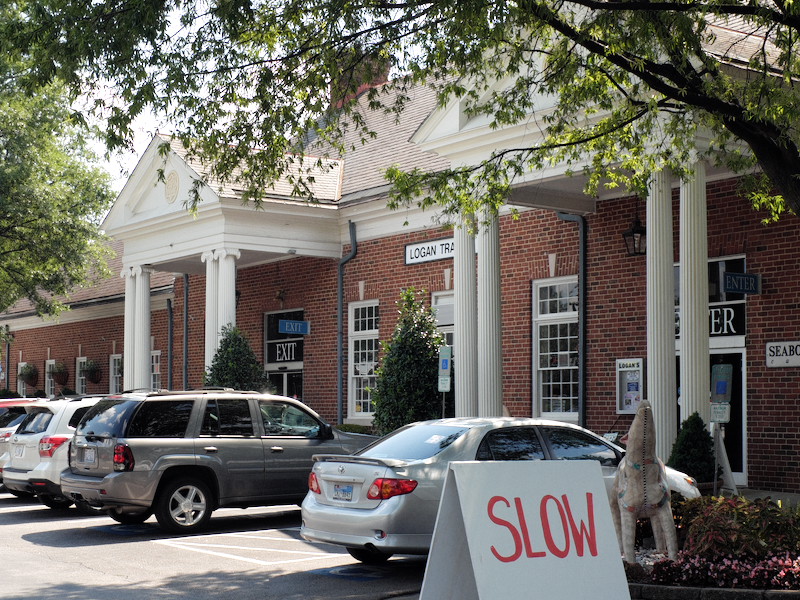
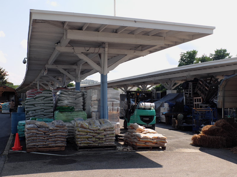
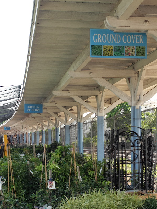
707 Semart Street
History: The building was built in
1942 and presently houses the Logan Trading Company. March
2004.
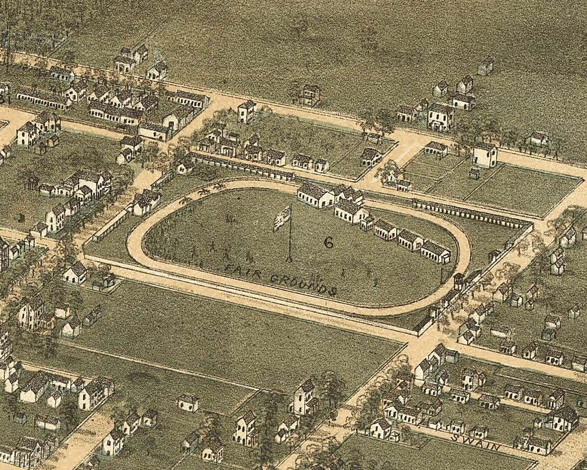
State Fairgrounds, First Location
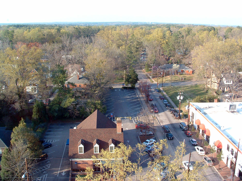
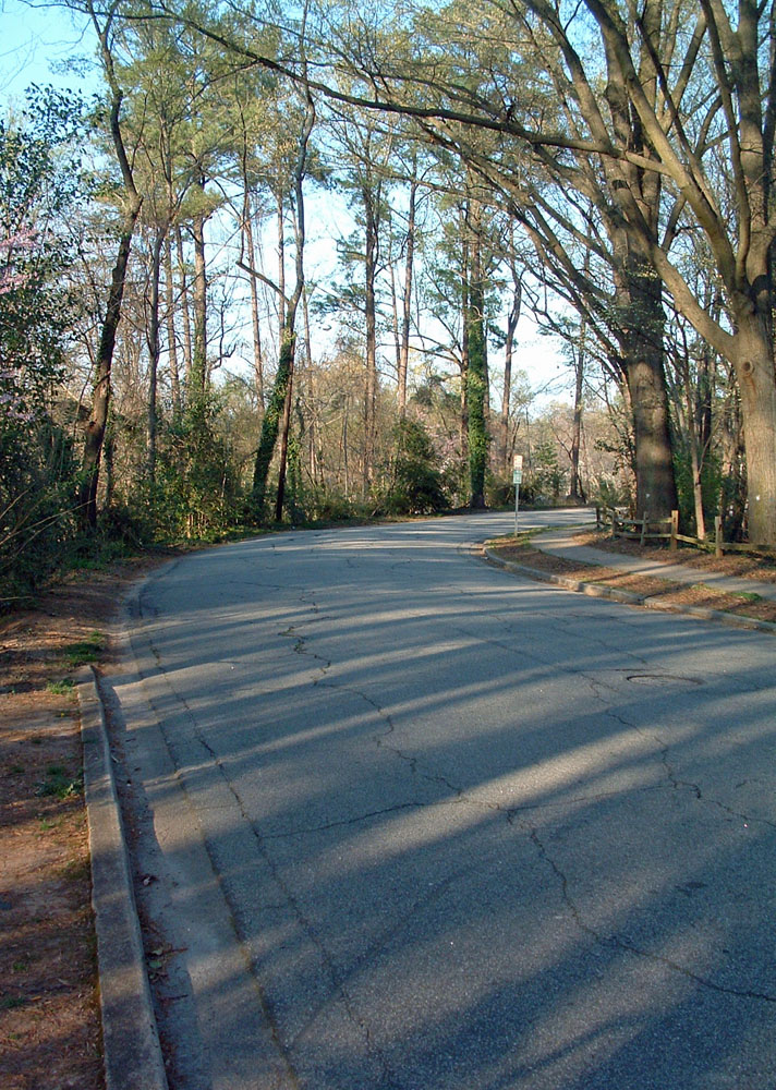
Confederate Soldier's Home
/ Old Soldier's Home / Pettigrew Hospital
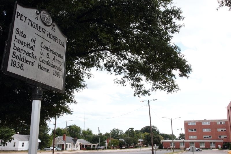
Photographed 2013
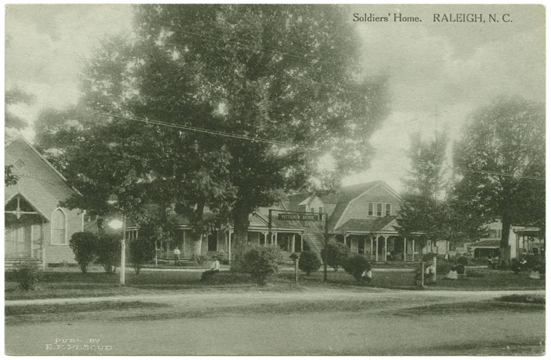
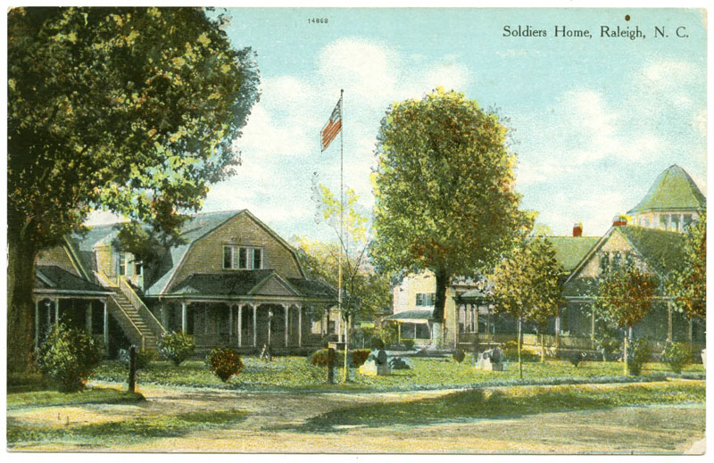
"Soldiers Home," Durwood Barbour
Collection of North Carolina Postcards (P077), North
Carolina Collection Photographic Archives, Wilson Library,
UNC-Chapel Hill
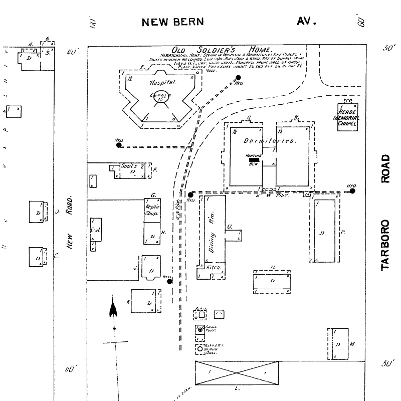
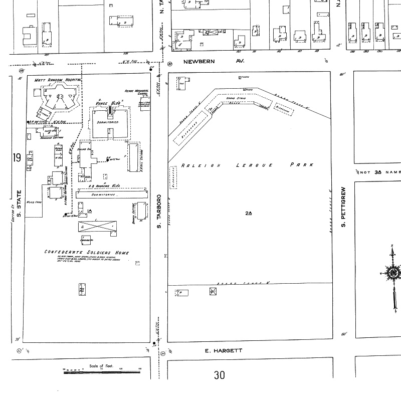
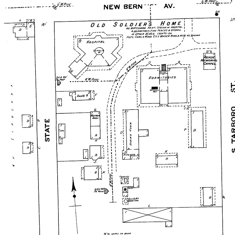
Sanborn Maps, 1903, 1909, 1914
Last updated: September 16, 2013
State Fairgrounds, Second Location
Photographed March 28, 2004
GIS map, 2016
Sanborn Map, 194
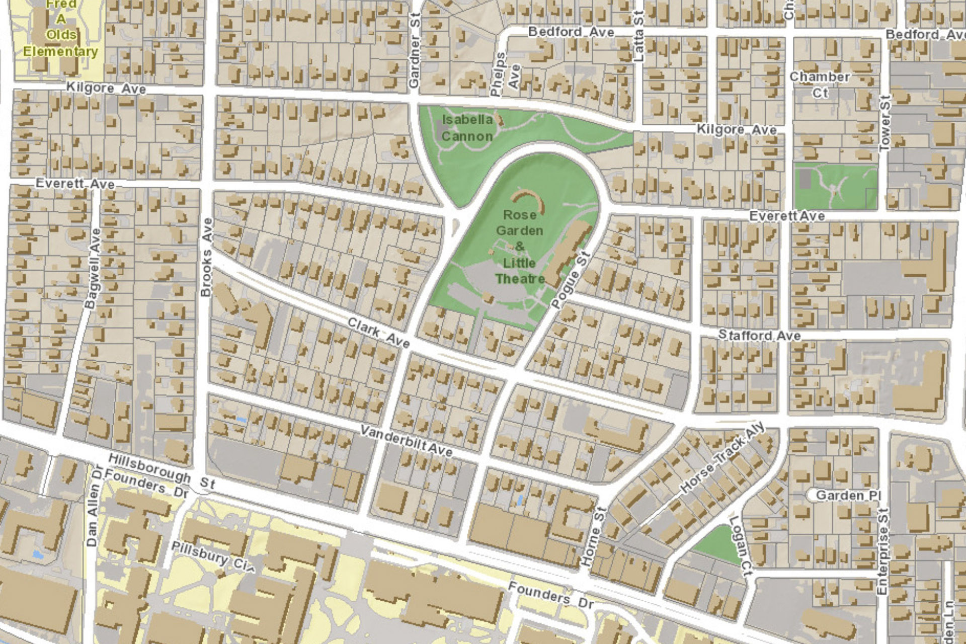
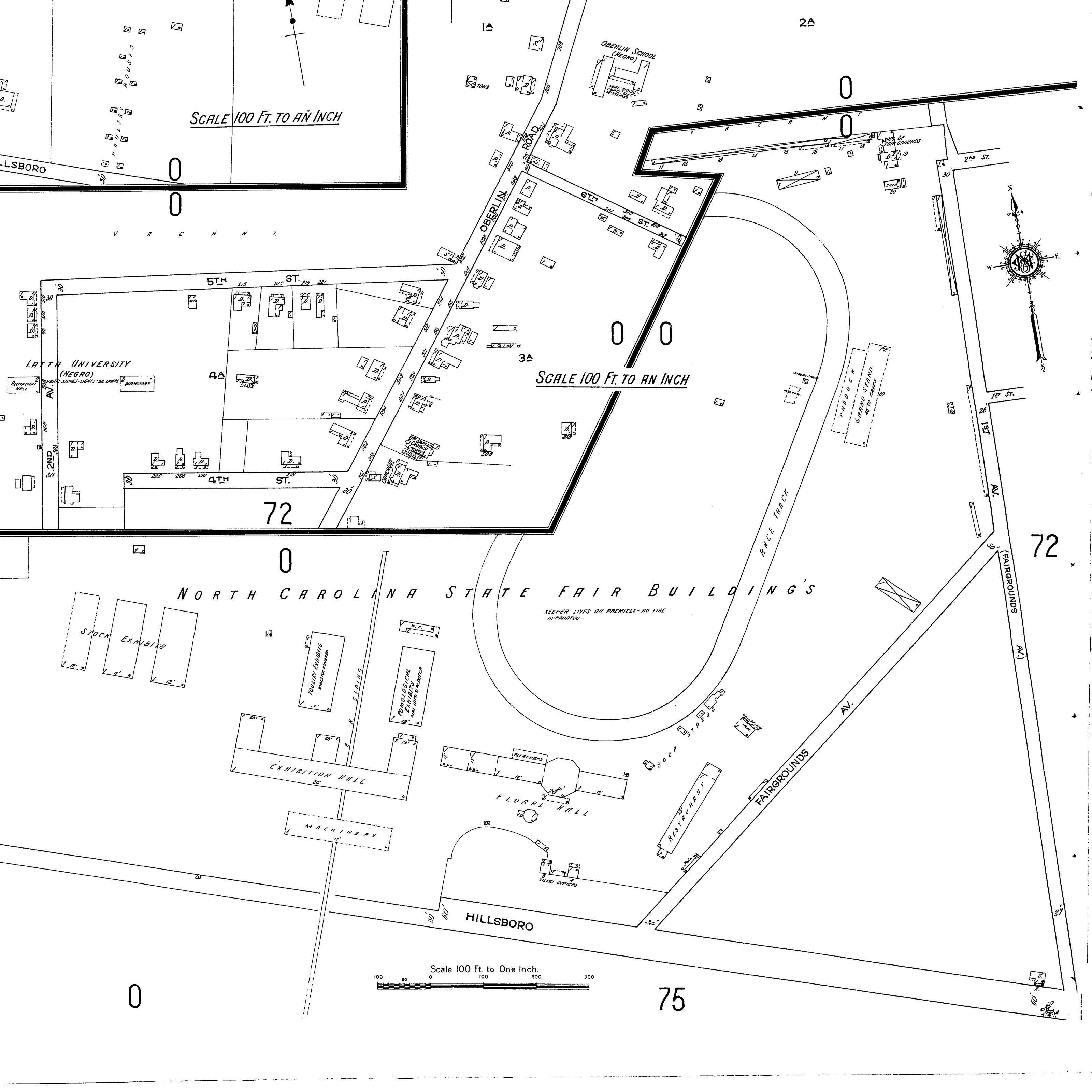
Fairmont Neighborhood
History: The first State Fair was founded
in 1853. The first site was a 16-acre tract about 10 blocks
east of the State Capitol. In 1873, the Fair moved to a
"55 acre broom sage field comprising an eminence known
as Cook's Hill on Hillsboro Road some 300 yards from the
N.C. and Augusta Air Line Railroad, one and one-quarter
miles west of the city limits of Raleigh." The site is
presently a residential and business district. In 1928, the
State Fair moved to its present site, with additional land
added in 1952. March 2004.
State Highway Patrol Communications Center
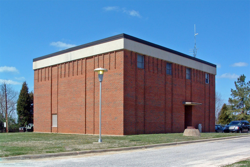
Photographed March 22, 2004
4000 block of District Drive.

Photographed March 24, 2004
3101 Hillsborough Street
History: The three-story building
was built in 1949 and later housed the Gregory Poole
Equipment Company. The site is present unoccupied.
March 2004.

Google Street View
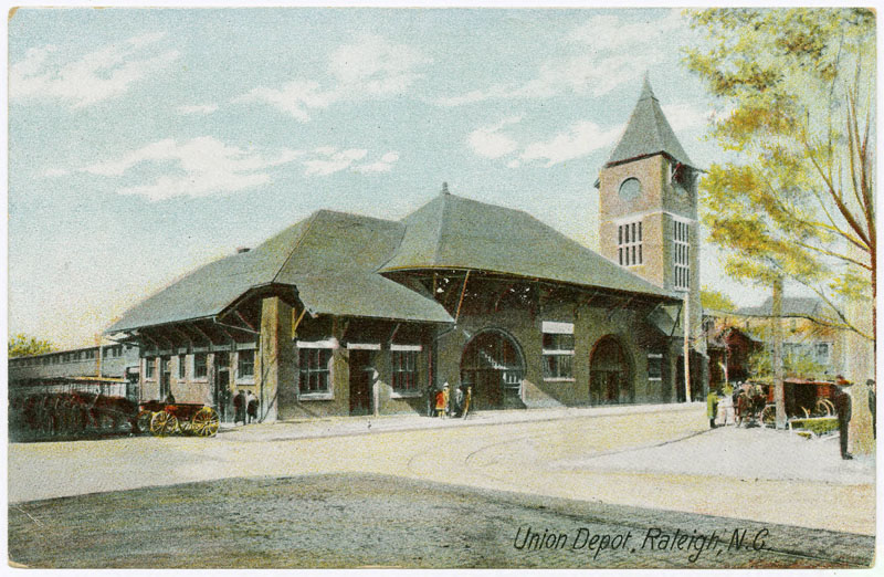
"Union Depot," Durwood Barbour
Collection of North Carolina Postcards (P077), North
Carolina Collection Photographic Archives, Wilson Library,
UNC-Chapel Hill
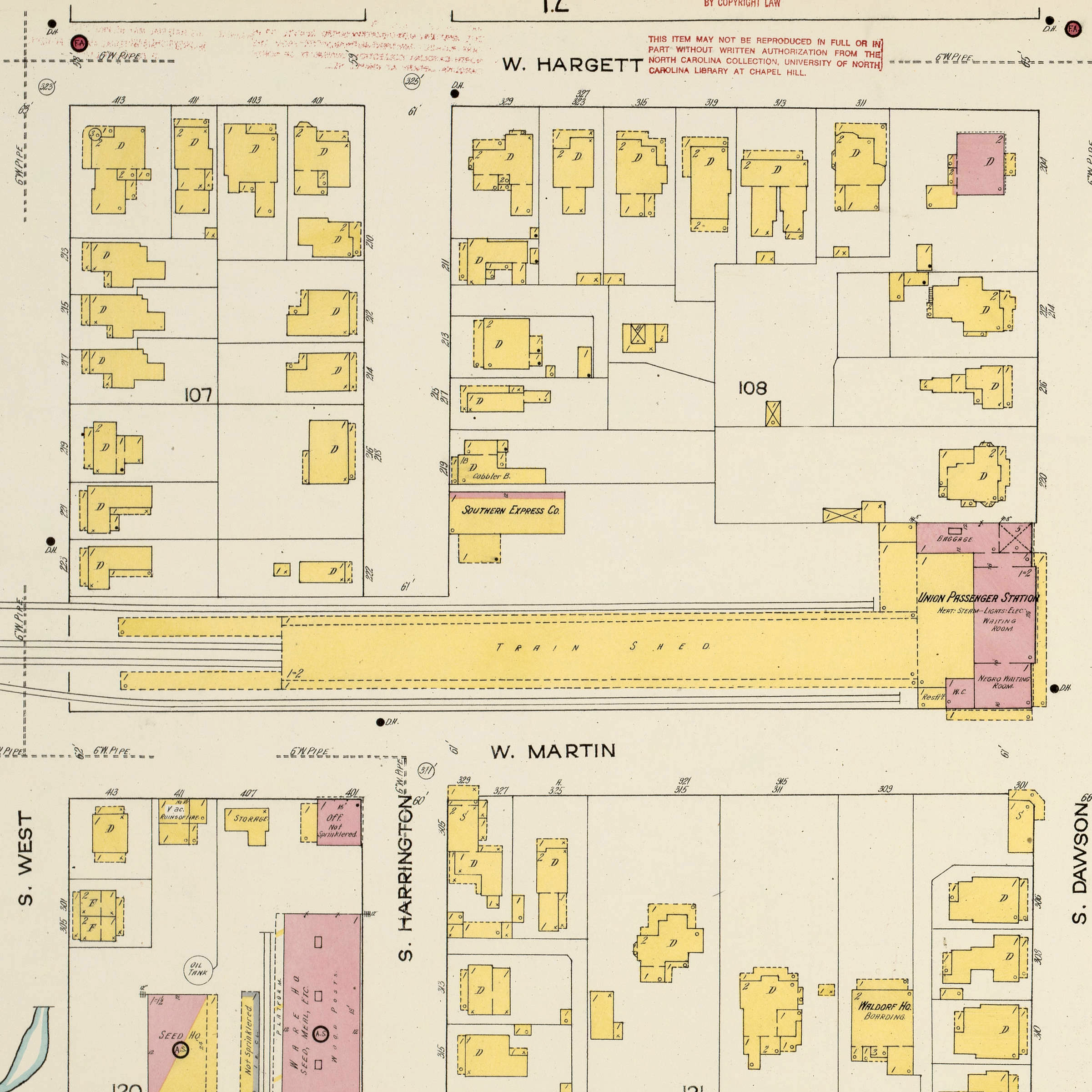
Sanborn Maps, 1914
Corner of West Martin and South Dawson streets.
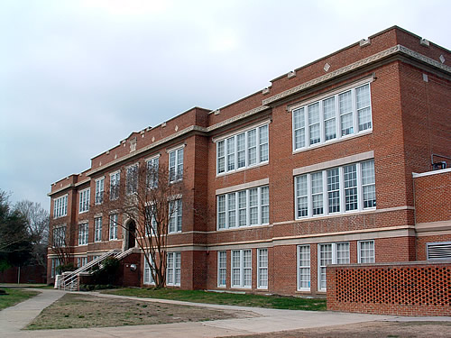
Washington School
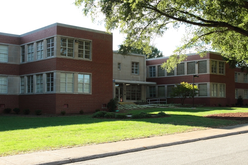
Photographed March 28, 2004
1000 Fayetteville Road
History: The first Washington School was a two story wooden building, built in 1869 on West South Street at McDowell Street. In 1875 the school was reorganized as a public school. In 1924, a new Washington Elementary and High School opened. The two-story, brick and stone Jacobean Revival style building was set above a one-story basement, had thirty classrooms, an auditorium, cafeteria, and library. It is presently an elementary magnet school. March 2004.
Copyright 2025 by Michael J. Legeros