Random Raleigh history. Locations of the four railroad turntables of yore, from a July 31, 2020, posting of mine on Facebook. They’re also mapped on Google Maps.
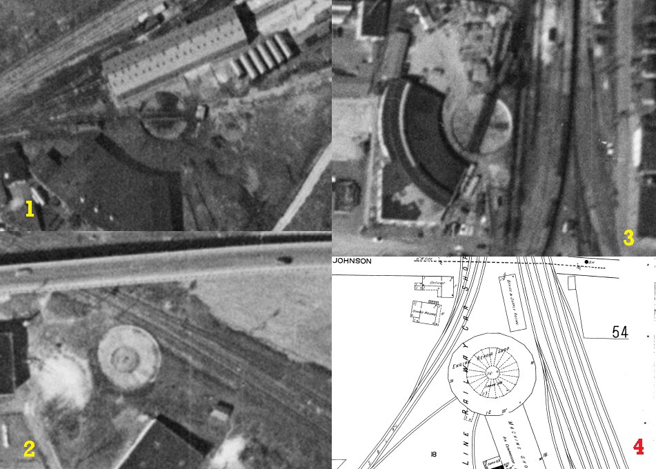
1 – Norfolk-Southern
USDA aerial photo, 1959
2 – Boylan Heights
USDA aerial photo, 1959
3 – West Johnson Street #1 – Seaboard Airline – Still operating
USDA aerial photo, 1959
4 – West Johnson Street #2 – Seaboard Airline – Presuming that a turntable was housed in that building.
Sanborn Map, 1914
Sources
USDA aerials
https://library.unc.edu/data/gis-usda
Sanborn Maps
That’s trickier. Hit the North Carolina Maps site, for public domain Sanborn Maps. But for the 1950 map, check the Library of Congress site. And if they don’t have that particular map digitized, use https://www.nclive.org which will require access via your local library card/account.