On Sunday morning, Yours Truly spent a couple hours crossing from east Carrboro into West Chapel Hill, and following the track tracks that end at the power plant.
That’s right, a coal train delivers their fuel, by way of a 10-mile spur from the Norfolk-Southern line that crosses through Orange County. But here’s another fun fact. The train tracks once extended even farther east, through campus!
Wait, what?
No time for a proper blog post, so here’s a list of links with all the information. Plus photos of Mike’s walking trip, as he tried to find (or at visualize) the old tracks on campus. Click away and the stories shall be revealed…
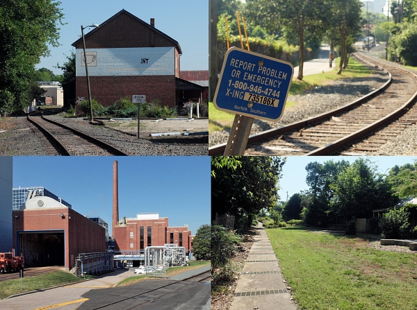
Maps and Diagrams
Click the first three to enlarge:
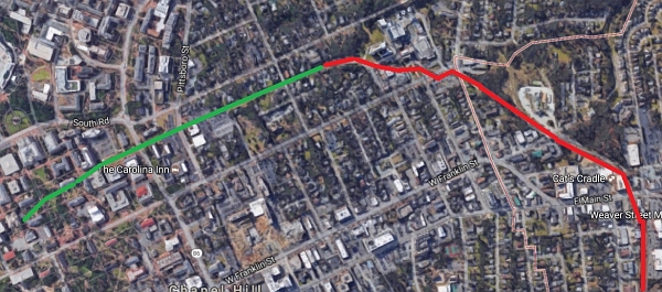
Google aerial map. Green are former tracks. Red are current tracks.
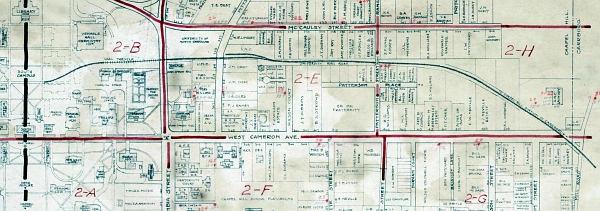
Street map of Chapel Hill and suburbs, 1932. See citation below.
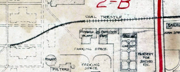
Close view of 1932 street map, showing coal trestle at prior power plant location. See reference below.
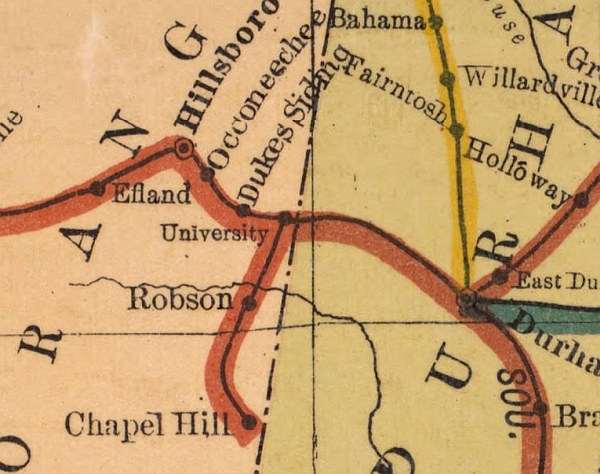
Railroad map of North Carolina, 1900. See reference below.
Map References
Chapel Hill and Suburbs, 1934 – Via North Carolina Maps
http://dc.lib.unc.edu/cdm/singleitem/collection/ncmaps/id/9735/rec/32
Railroad map of North Carolina, 1900 – Via North Carolina Maps
http://dc.lib.unc.edu/cdm/ref/collection/ncmaps/id/506
Photos
Legeros photo album
https://www.flickr.com/photos/legeros/sets/72157681602398394
Articles
Daily Tar Heel – Rolling through the history of Carrboro’s Train – November 17, 2015
http://www.dailytarheel.com/article/2015/11/rolling-through-the-history-of-carrboros-train
Open Durham – University Station
http://www.opendurham.org/buildings/university-station