Morning map play. Using USDA aerial images from 1959 and 1971 to pinpoint the exact location of the original Six Forks FD locations. Plus a 2021 aerial image noting their approximate locations today. Maps via UNC Library.
From my notes:
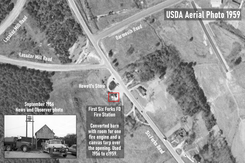
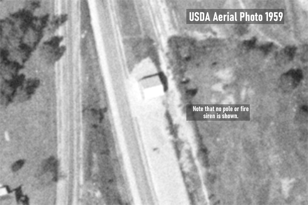
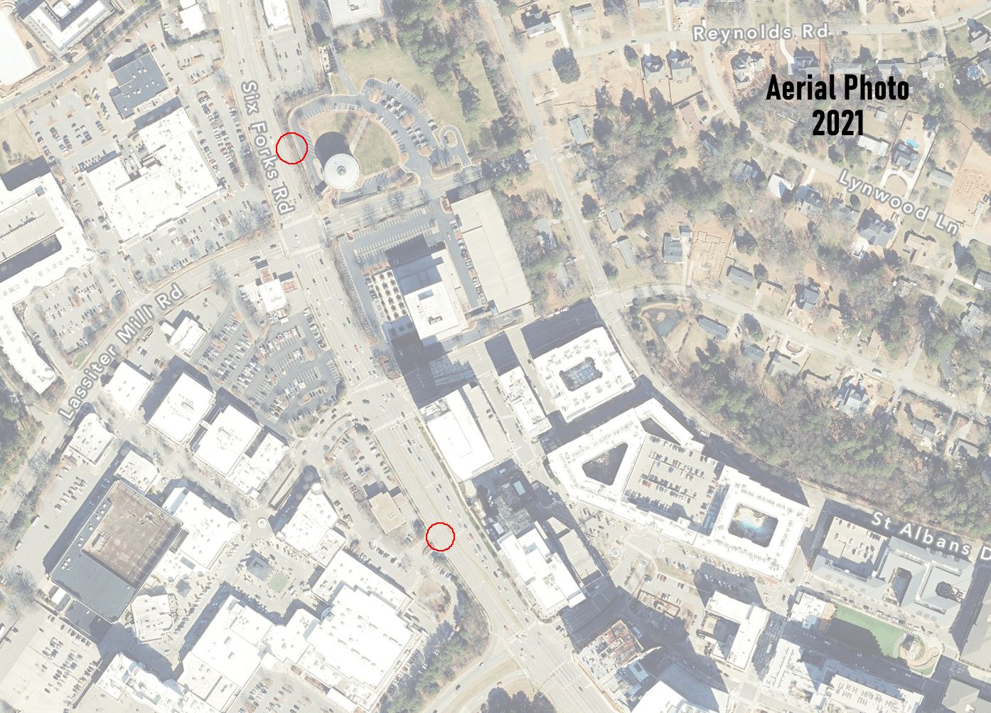
- 1956, first fire station is converted barn on south side of Howells Store at 4129 Six Forks Road, which was located just south of the second/southern section of Lassiter’s Mill Road and Six Forks Road. Later location of Firestone Tires at North Hills Mall. The barn had room for one fire engine, and a canvas tarp covering the opening. There was a 7.5 HP siren on a pole beside the barn. The barn was being used as a fire station by September 1956.
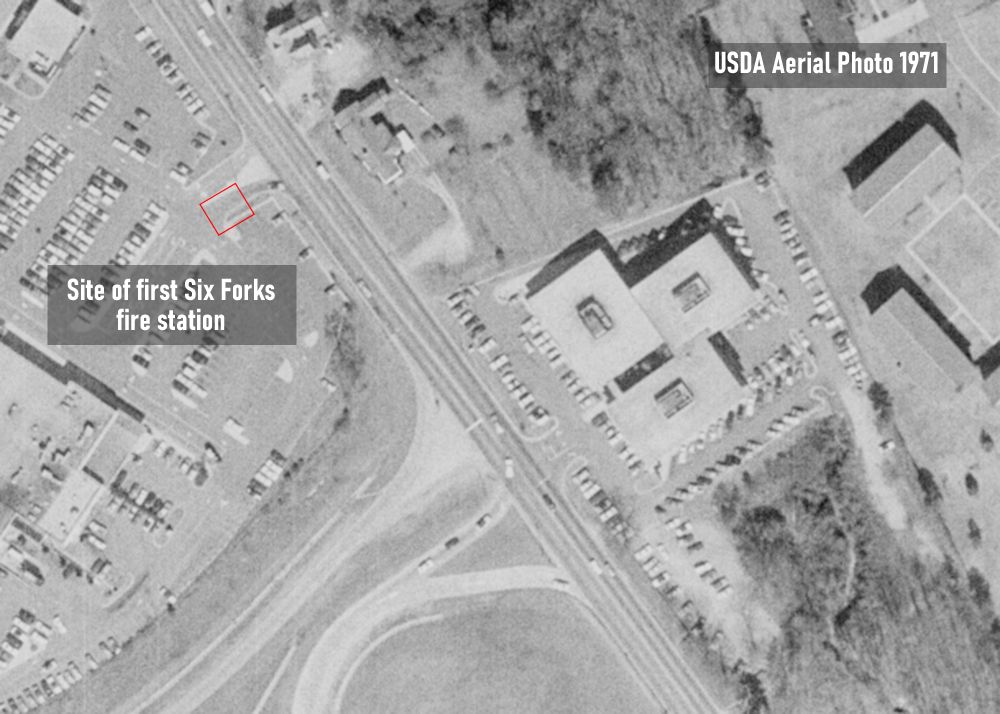
- 1959, circa, second fire station is a tin structure with a gravel floor in the 4400 block of Six Forks Road, on the east side of Six Forks, about mid-block. The building had room for two trucks, and a pair of pivoting doors. It was erected by March 1959. The fire department vacated its original location behind Howell’s Store. [Wish we had a surviving photo of this building.]
- 1962/63, third fire station location is 5305 Six Forks Rd. Three-bay building constructed. Present location of EMS station #3. The 7.5 HP siren is moved farther north on Six Forks Road, to a spot near Northclift, near Sandy Forks Road. The alarm on the building itself is a 12-volt, battery-powered vehicle siren. From the Wake County BOC meeting on November 5, 1962, the department is reported as in process of building a new fire house, and will “assume its fire protection responsibilities January 1, 1963.”


Facebook Comments